
| Voyage: 08 April 1879 - 25 September 1879 |
|---|
S. S. Kangaroo
|
Introduction
This page concerns John Seymour's 1879 voyage, as Master of the SS Kangaroo, to Natal to lay the "first Cape cable section". This section of cable extended from Natal (now Durban, South Africa) to Delagoa Bay (now Maputo Bay in Southern Mozambique). The work was undertaken by the Telegraph Construction & Maintenance Company (Telcon), based at 38 Old Broad street, London EC, and Kangaroo was one of the four ships they had registered in 1879 (Calabria, Kangaroo, Scotia, & Seine).
Upon arriving in Natal, on 26 May 1879, to find that the contract between the Cape Colony Government and Telcon had ben repudiated. Kangaroo remained, idle, in Natal Harbour for the ensuing five weeks while, presumably, contract matters were renegotiated. Cable work began in 05 July, from Natal, and finished, on 21 July, at Delagoa Bay.
After this cable was laid Kangaroo proceeded to take detailed soundings in preparation for the laying of other segments of the Cape Cable (Mozambique - Delagoa Bay & Zanzibar - Mozambique). Kangaroo returned, later in 1879, and with Scotia laid the final section of the Cape Cable, from Aden to Zanzibar (Kangaroo's 12 Nov 1879 - 06 May 1880 voyage).
The scanned hand-written entries, found throughout this page, are from a "Remark Book of the S. S 'Kangaroo'" and are mostly in the hand-writing of John Seymour.
 |
First entry into John Seymour's "remark book" detailing his 1879 and 1880 voyages in CS Kangaroo and including observations from several other voyages during subsequent years. |
Question marks [?] denote uncertain transcribed text ... suggestions and explanations are welcomed. Asterisks denote items that are expanded upon, or discussed, in associated notes and footnotes while exclamation marks [!] are used to highlight items of interest.
The ship and her crew
| Ship | Kangaroo. ON 1608. Registered London: 22/1876. |
| Owner | Registered managing owner: Admiral Sir G Richard, 38 Old Broad Street, London, England. |
| A voyage | from "London to Port Natal and any ports and places in the Cape, Australian & New Zealand Colonies, India, China, Japanese and Red Seas & Straits & Persian Gulf, North & South pacific & Atlantic Oceans, United States of America between Portland and Galveston inclusive, West coast of America & islands adjacent, West Indies & Continent of Europe including the Mediterranean & Baltic Seas, [??] for any period not exceeding two years, and back to the final port of discharge in the United Kingdom" |
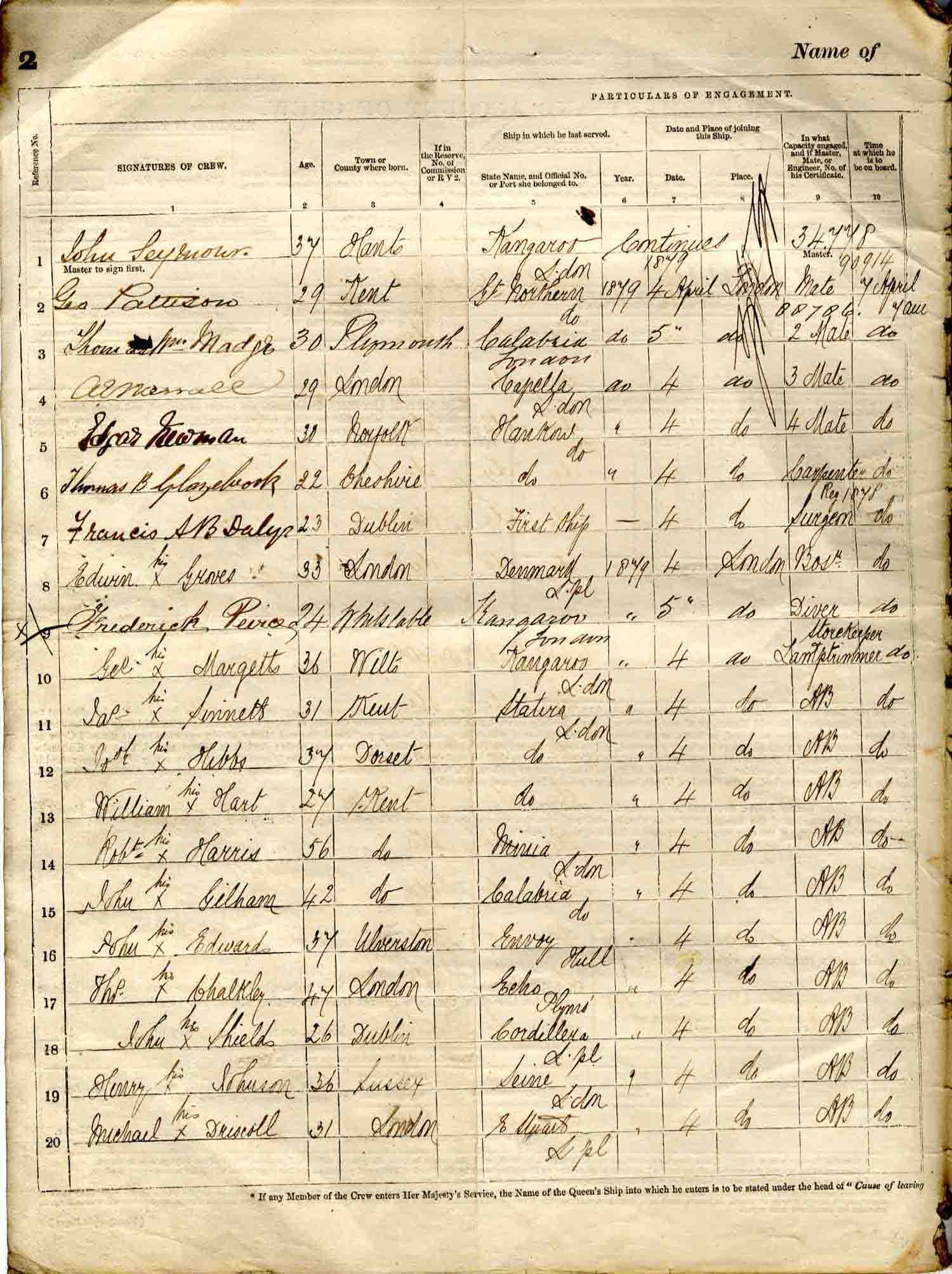
| Ship's crew and personnel | |
| Master | John Seymour (34.778), previously "same ship". |
| Mate | George Pattison (90.914), previously Great Northern 1879. £14/- per month. |
| 2 mate | Thomas Wm Madge (00.706*), previously Calabria 1879. £12/- per month. |
| 3 mate | A E Merrall, previously Capella 1879. £10/- per month. |
| 4 mate | Edgar Newman, previously [??]Hankow 1879. £8/- per month. |
| Surgeon | Francis A B Daly, first ship. £14/- per month. |
| Carpenter | Thomas B Glazebrook, previously [??]Hankow 1879. £8/- per month. |
| Bosun | Edwin Groves, previously Denmark 1879. £8/- per month. |
| Diver | Frederick Peirce, previously Kangaroo 1879. £8/- per month. |
| Other | George Margetts, Storekeeper & Lamp Trimmer, previously Kangaroo 1879. £4/10/- . and 49 others: 1 Chief Steward; 1 Second Steward; 1 Chief Cook; 1 Second Cook; 1 Butcher; 1 Scullion; 1 Pantryman; 1 Storekeeper; 1 Assistant Steward; 7 Stewards; 1 "OS" Ordinary Seaman; 1 boy; 18 Cablemen; 9 Electricians; 1 Cable hand; 1 Painter; and 2 Telegraph Engineers ... to a total of 105. |
| Notes | Thomas Madge's certificate number, on this agreement, appears inconsistent with that reported on subsequent voyage. Handwriting suggests it is the same person. Another 'Madge', possibly a brother, is a mate on the crew of other Seymour voyages. |
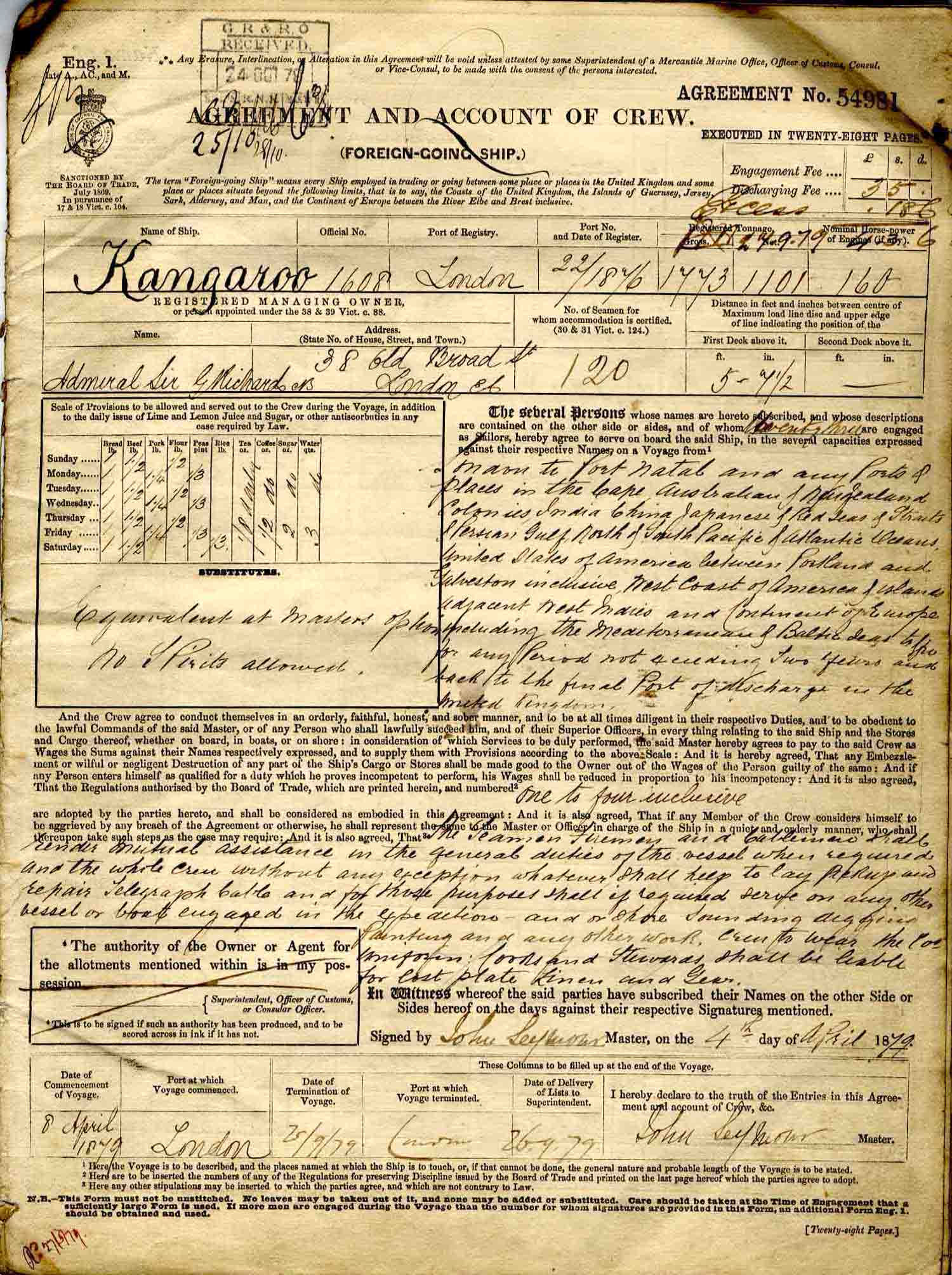
Agreement and Account of Crew (Foreign-going ship): No 54981
 |
 |
click on image to view high resolution version (5x) |
|
First two pages of the "Agreement and Account of Crew (Foreign-going ship)" number 54981, for the 08 April 1879 - 25 September 1879 voyage of the cable-ship S S Kangaroo, under Master John Seymour |
|
The voyage
The bulk of this section is a day-by-day description of the voyage. This table summarises the voyage into sections and notable events ... with links to the relevant entries.
| Dates | Voyage segments and events. | ||
| 09 Apr - 26 May | Outbound: Gravesend, England to Natal, Cape Colony. | ||
| 13 Apr | Finisterre. | ||
| 16 Apr | Straits of Gibraltar. | ||
| 20 - 21 Apr | Malta. Discharging sick diver, to hospital. | ||
| 25 Apr | Swinging ship's compass. | ||
| 27 Apr | Suez Canal. | ||
| 28 Apr | Pick up Mr London and Mr Laws at Suez. | ||
| 01 May | Red Sea. | ||
| 04 - 06 May | Aden. | ||
| 11 May | "Smallest days work since leaving England". | ||
| 17 May | Comoro Island (Comoros) and the Mozambique Channel. | ||
| 22 - 26 May | Soundings: Inyack Island - Delagoa Bay. | ||
| 26 May | Arrival into Natal Harbour. Contract repudiated! | ||
| 27 May - 04 Jul | No journal entries. Probably ongoing contract negotiations. | ||
| 05 - 21 July | Cable laying: Natal - Delagoa. | ||
| 06 - 09 Jul | Work halted due to weather. | ||
| 10 Jul | Cable work recommences. | ||
| 21 Jul | Final splice and bight. Laying of Natal - Delagoa section of cable completed. | ||
| 22 - 25 Jul | Lourenço Marques. | ||
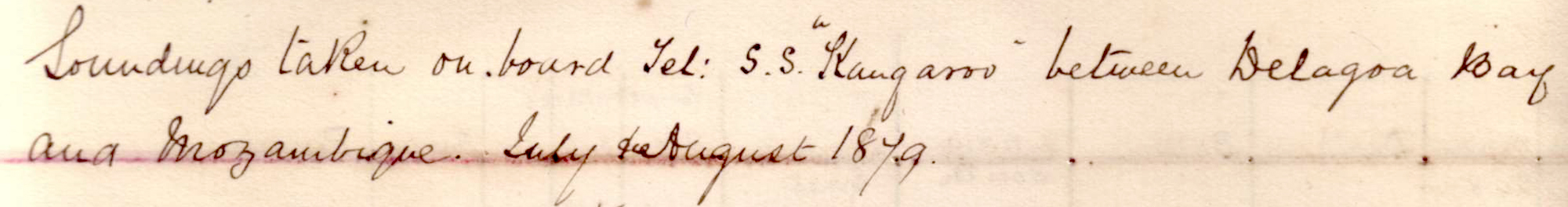
| 26 Jul - 03 Aug | Taking soundings. | ||
| 26 - 28 Jul | Soundings between Cutfield Flat, Delagoa Bay and Mozambique. | ||
| 28 Jul - 03 Aug | Soundings between Delagoa Bay and Mozambique. | ||
| 03 - 07 Aug | Mozambique Harbour (Met up with S S "Seine"). | ||
| 07 Aug - 25 Sep | Return: Mozambique to Gravesend, England. | ||
| 10 - 12 Aug | Zanzibar. | ||
| 21 - 22 Aug | Aden. | ||
| 31 Aug | Suez Bay. | ||
| 08 - 09 Sep | Malta. | ||
| 17 Sep | Gibraltar. | ||
| 21 Sep | Near Portugal. | ||
| 25 Sep | Gravesend, England. | ||
Wednesday, 09 April 1879
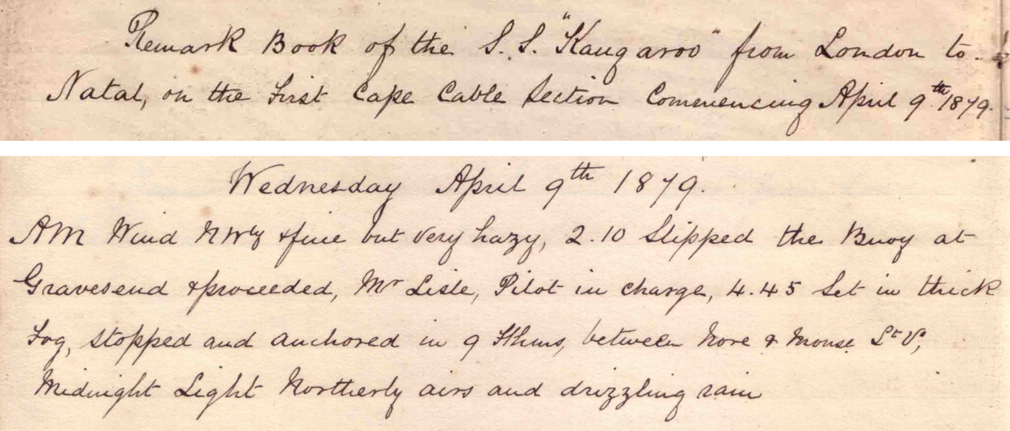 |
click on image to view high resolution version (5x) |
Leaving Gravesend, England.
"2.10 slipped the buoy at Gravesend & proceeded. Mr Leslie, Pilot in charge. 4.45 set in thick fog, stopped and anchored in 9 fathoms, between Hore & Mouse Lights."
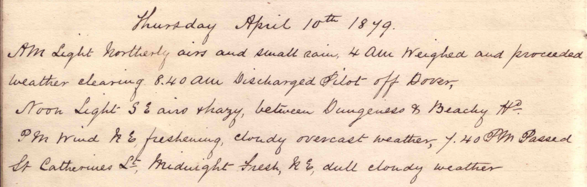
Thursday, 10 April 1879
 |
click on image to view high resolution version (5x) |
"4am weighed and proceeded." "8.40am discharged pilot off Dover." Noon: "between Dungeness & Beachy Head."
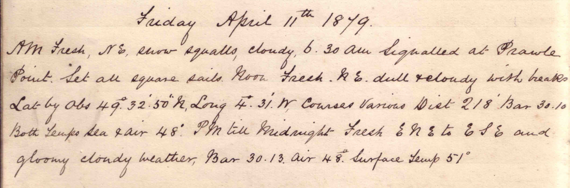
Friday, 11 April 1879
|
click on image to view high resolution version (5x) |
"Signalled at Prawle Point. Set all square sails."
Noon position (Latitude by observation): N 49° 32' 50" W 4° 31', at SW end of the English Channel about halfway between England & France.
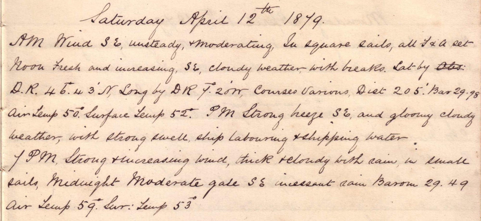
Saturday, 12 April 1879
 |
click on image to view high resolution version (5x) |
"In square sails, all F & A set."
Noon position (Lat & Long by DR): N 46° 43' W 7° 20', almost half way across the mouth of the Bay of Biscay.
Sunday, 13 April 1879
 |
click on image to view high resolution version (5x) |
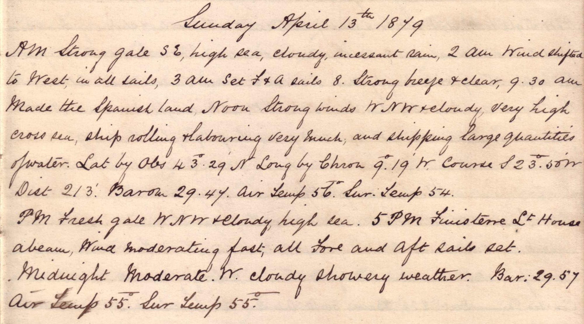
"Strong gale." "9.30am made the Spanish land." "Ship rolling and labouring very much and shipping large quantities of water."
Noon position: N 43° 29' W 9° 19', about 40km offshore from the NW tip of Spain.
"5pm Finisterre Lighthouse abeam."
Monday, 14 April 1879
 |
click on image to view high resolution version (5x) |
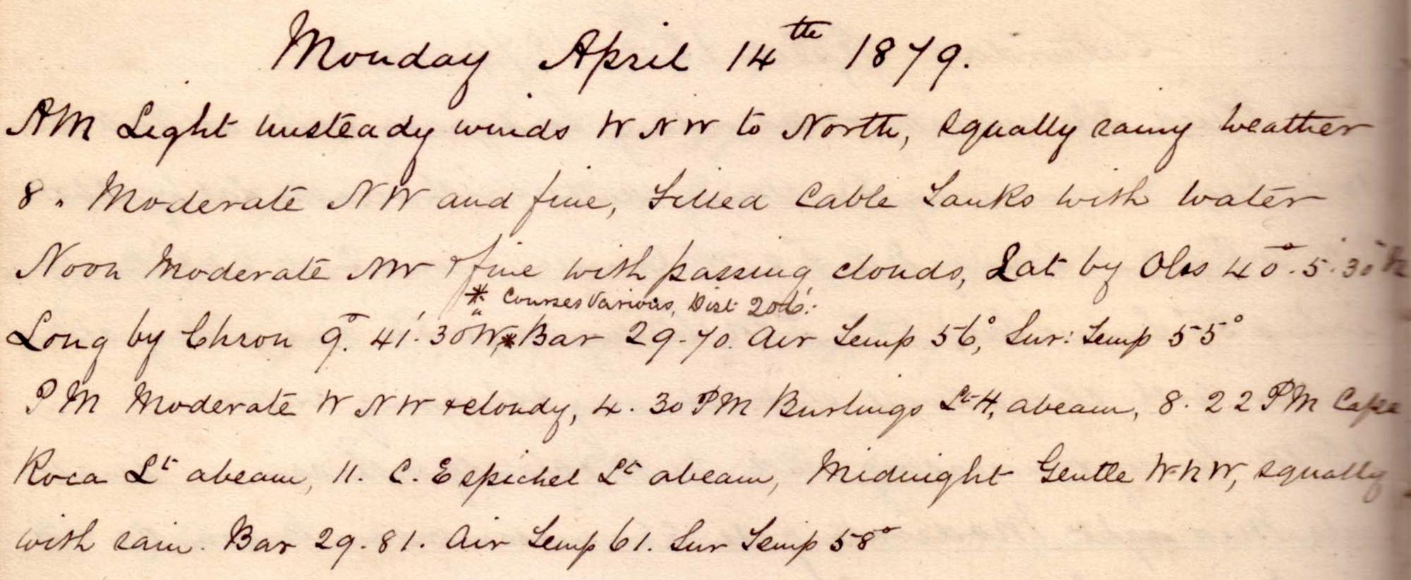
Sailing south off the Portuguese coast.
"Filled cable tanks with water."
Noon position: N 40° 5' 30" W 9° 41' 30", approximately 65km off the Western Portuguese coast 160km NNW of Lisbon, Portugal.
"8.22pm Cape Roca light abeam."
Tuesday, 15 April 1879
 |
click on image to view high resolution version (5x) |
Heading south along the Western coast of Portugal and then turning SE towards the Straits of Gibraltar.
Variable and showery. "9.20am Cape St Vincent abeam, 9.40 signalled at station."
Noon position: N 36° 49' 50" W 8° 33' 45", about 30km from S Portuguese coast and 300km NW of the straits of Gibraltar.
"PM till midnight moderate NW & fine, all available sails set."
Wednesday, 16 April 1879
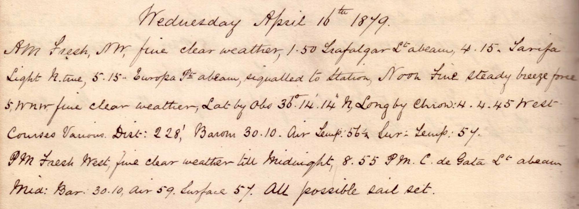 |
click on image to view high resolution version (5x) |
Passing eastward through the Straits of Gibraltar.
"1.50am Trafalgar Lt abeam, 4.15 Tarifa Light, 5.15 Europa Pt [Southernmost point of Gibraltar] abeam, signalled to station."
Noon position: N 36° 14' 14" W 4° 4' 45", approximately 130kn ENE of the Straits of Gibraltar.
"8.55pm C de Gata Lt abeam." "All possible sail set."
Thursday, 17 April 1879
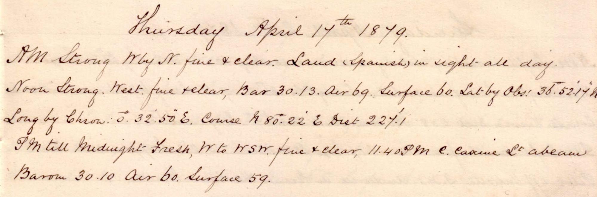 |
click on image to view high resolution version (5x) |
Sailing East, from Gibraltar, towards North African coastline.
"Land (Spanish) in sight all day." to the North.
Noon position: N 36° 51' 17" E 0° 32' 50", approximately 60km N of Algerian coast, 225km W of Algiers (El-Jazair).
"11.40pm C Caxine Lt abeam."
Friday, 18 April 1879
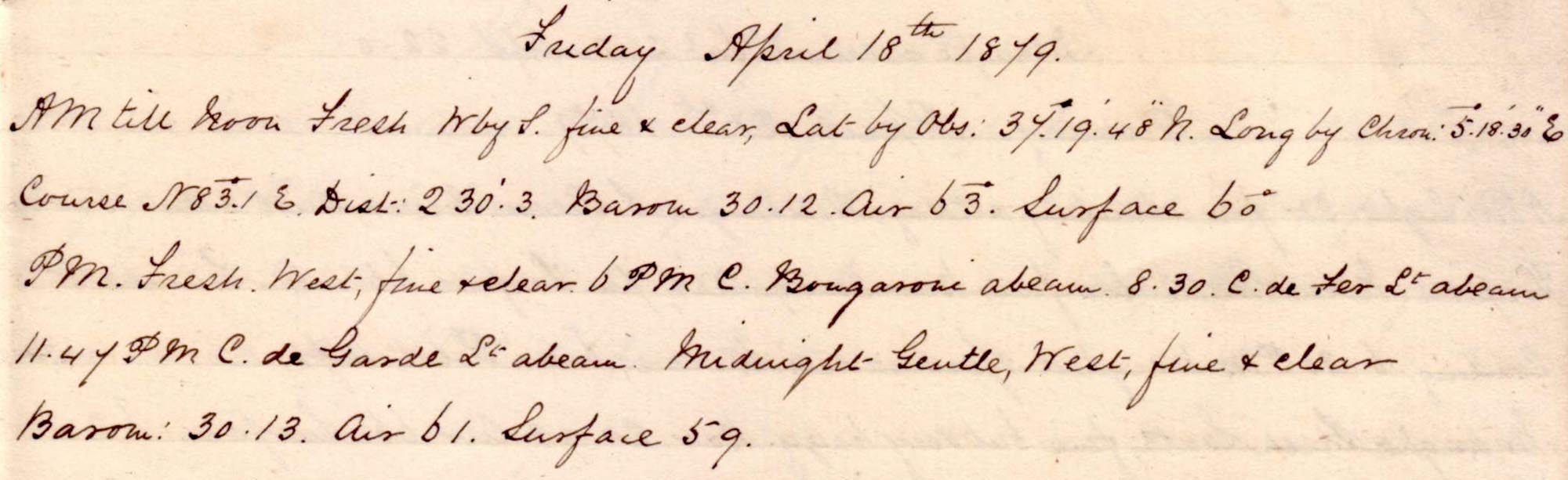 |
click on image to view high resolution version (5x) |
Sailing East, close to the North African coastline, past Algeria.
Noon position: N 37° 19' 48" E 5° 18' 30", approximately 65km N of Algerian coast, 210km NE of Algiers (El-Jazair).
"11.49pm C de Garde Lt abeam."
Saturday, 19 April 1879
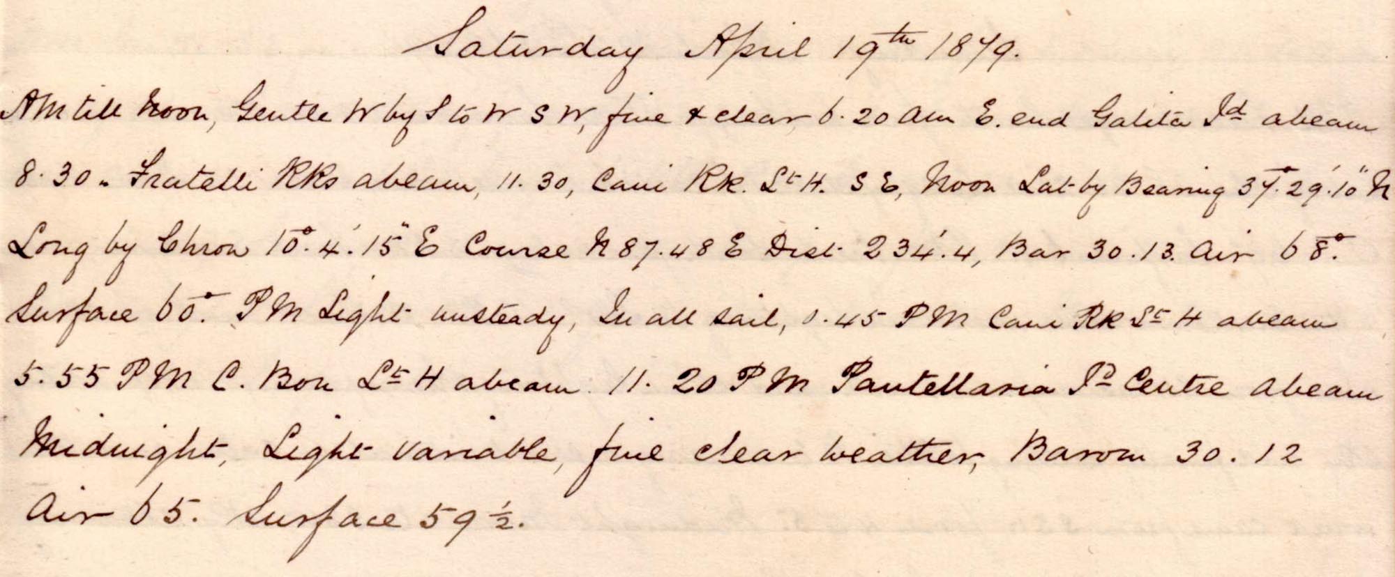 |
click on image to view high resolution version (5x) |
Sailing East, close to the North African coastline, past Tunisia.
"6.20 am E end Galita Is abeam."
Noon position: N 37° 29' 10" E 10° 4' 15", about 25km N of Tunisian coast, 75km NNW of Tunis.
"11.20pm Pantellaria Is Centre abeam".
Sunday, 20 April 1879
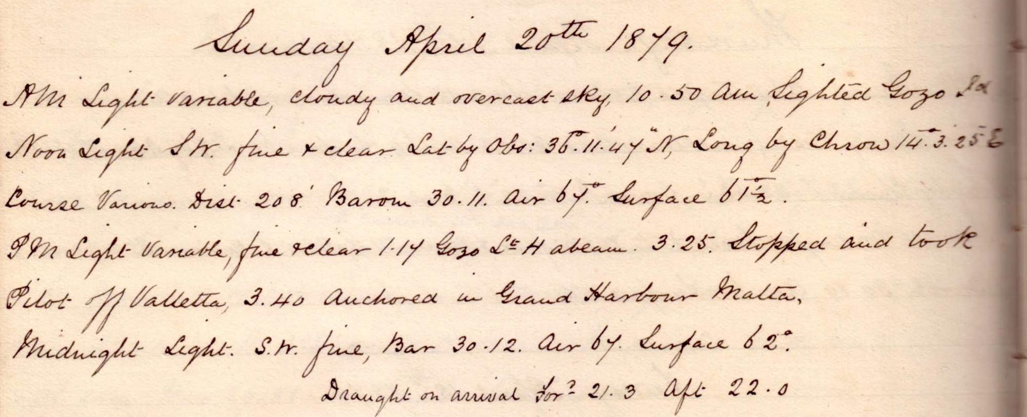 |
click on image to view high resolution version (5x) |
Heading East to Malta.
"10.50am Sighted Gozo Is"
Noon position: N36° 11' 47" E 14° 3' 25", 20km NW of Gozo Island which, in turn, is immediately NW of Malta.
"3.25pm. Stopped and took pilot off Valletta. 3.40 anchored in Grand Harbour Malta."
Monday, 21 April 1879
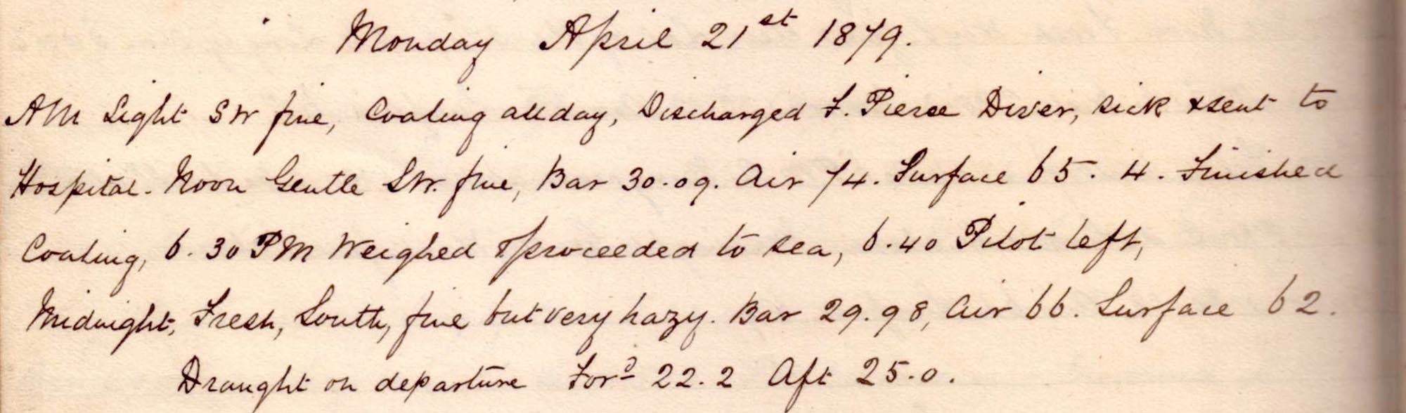 |
click on image to view high resolution version (5x) |
Coaling, discharging diver to hospital, and then departing Malta.
At Malta: "Discharged F Pierse, Diver, sick & sent to Hospital".
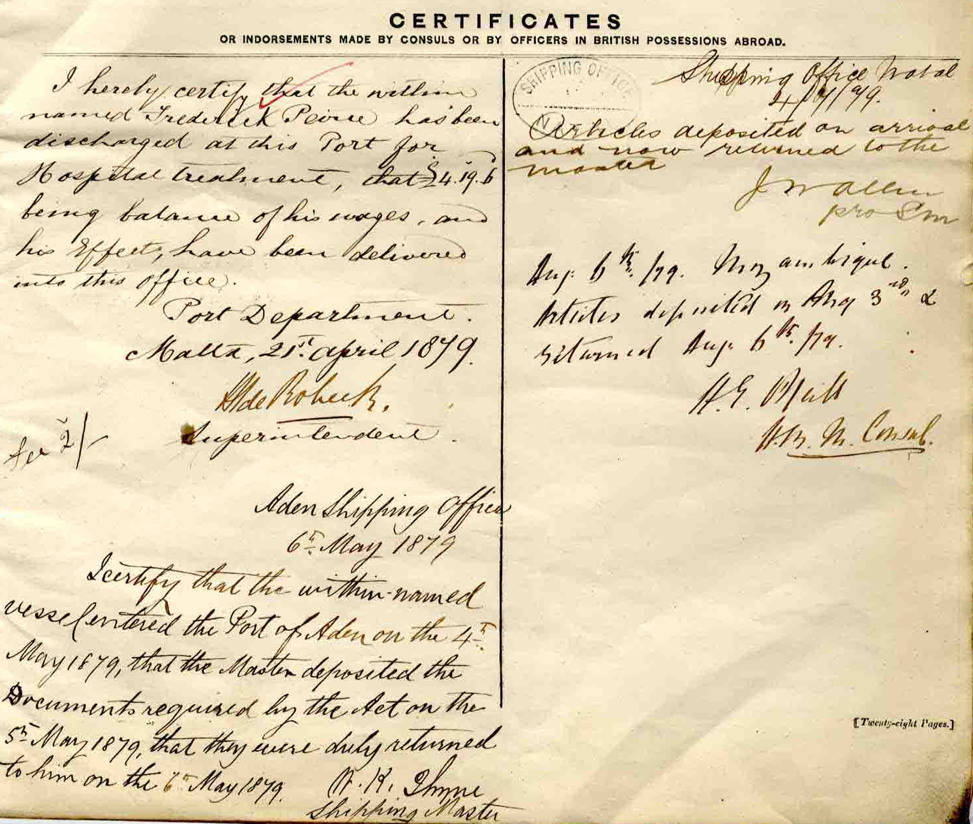 |
click on image to view high resolution version (5x) |
| "Certificates" section on p14 of "Agreement and Account of Crew (Foreign-going ship)" number 54981. Upper-left entry, dated 21 April 1879, is the Superintendent of the Malta Port Department certifying Pierse/Peirce's discharge from the Kangaroo to hospital, and the payment of his wages and handing-over of his personal effects. |
"4[pm] finished coaling, 6.30pm weighed & proceeded to sea, 6.40 pilot left".
Before-and-after draught measurements possibly an indirect measure of the weight of coal taken on board in Malta.
Tuesday, 22 April 1879
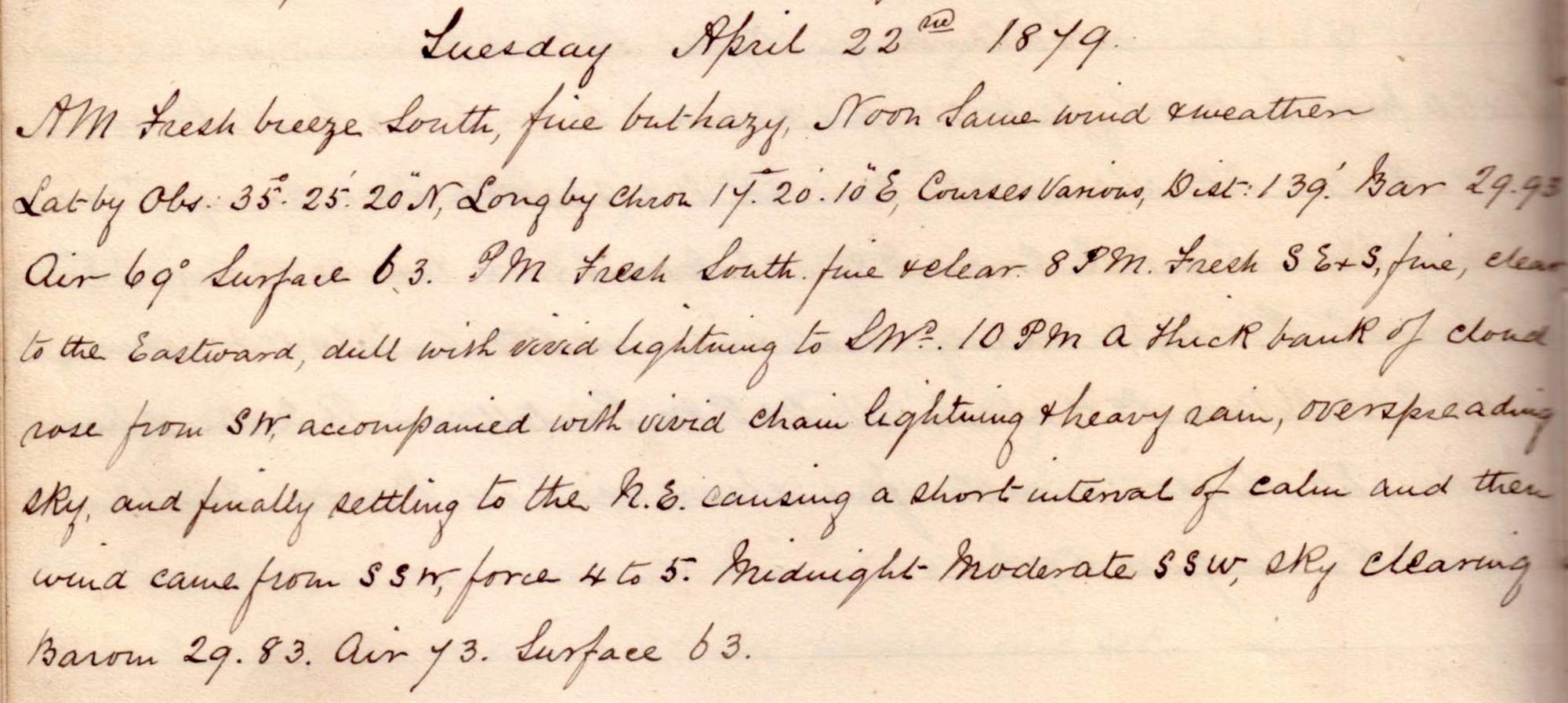 |
click on image to view high resolution version (5x) |
Heading from Malta towards the Suez Canal.
Noon position: N 35° 25' 20" E 17° 20' 10", about 260km ESE of Malta.
Storms to the SW. Brief period of high wind and then settled a little into the night.
Wednesday, 23 April 1879
 |
click on image to view high resolution version (5x) |
Stormy weather clearing into the day.
Noon position: N 34° 23' 50" E 21° 5' 48", half way between Southern Greece and N coast of Eastern Libya.
Thursday, 24 April 1879
 |
click on image to view high resolution version (5x) |
Noon position: N 33° 17' 25" E 25° 6' 45", half-way between Crete and the Northern Libya/Egypt border.
"pm Gentle to light airs ... In all sails."
Friday, 25 April 1879
 |
click on image to view high resolution version (5x) |
"All F & A set" (fore and aft sails).
Noon position: N 32° 28' 5" E 28° 53', about 170km NW of Alexandria (Al Iskandariyah), Egypt.
"In all sails, swing ship round the compass for azimuths".
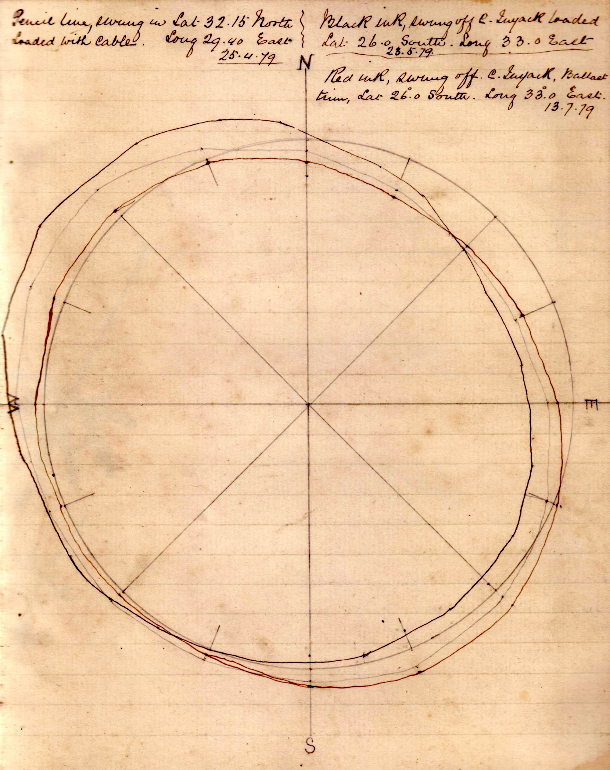 |
| click on image to view high resolution version (5x) |
| This graph is the result of the swinging the ship round the compass manoeuvre: "Pencil line, swung in Lat 32.15 North, Long 29.40 East. Loaded with cable. 25.4.79." The other two lines were similar swingings undertaken later in this voyage. |
Saturday, 26 April 1879
 |
click on image to view high resolution version (5x) |
Arrival at Port Said and passage into Suez Canal.
Noon position: N 31° 21' 40" E 32° 19' 20", 12km North of Port Said and the Northern entrance to the Suez Canal.
"12.25 stopped, took pilot. 1.15pm Made fast to buoy at Port Said. 3.15 M de Rosa pilot came on board, slipped buoy & proceeded. 3.30pm entered the Suez canal". "7.30pm Stopped & made fast at 2nd station."
Sunday, 27 April 1879
 |
click on image to view high resolution version (5x) |
Transiting the Suez Canal.
"5.5am cast off & proceeded, 7 made fast - block ahead, steamer touching. 7.35 proceeded." Noon "changed pilots at Ismailia (Isma'iliyah)".
"2.50 Entered Gt Bitter Lake, 5.30 entered canal again, 7.20 made fast for the night 79' from Port Said."
Monday, 28 April 1879
 |
click on image to view high resolution version (5x) |
Sailing SE to end of the Suez Canal and then into the Gulf of Suez.
"4.45am Cast off and proceeded, 6.55, Stopped off Suez to discharge Pilot, and pick Messrs London & Laws. 7.15 proceeded, 7.34 Passed the [?]Light Vessel."
Noon position: N 29° 14' E 32° 43' 30", in the middle of the Gulf of Suez about 240km NW of entrance into Red Sea.
Tuesday, 29 April 1879
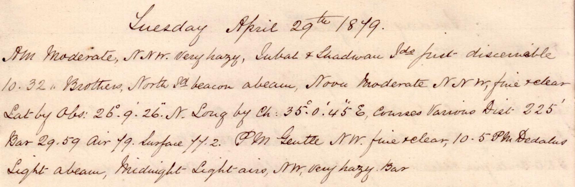 |
click on image to view high resolution version (5x) |
Sailing SE down Gulf of Suez and into the Red Sea.
"Very hazy, Gubal & Shadwan Islands (Strait of Gubal, where Gulf of Suez enters Red Sea) first discernable 10.32."
Noon position: N 26° 9' 26" E 35° 0' 45", about 180km into the Red Sea from the Strait of Gubal.
"10.5pm Dedalus light abeam."
Wednesday, 30 April 1879
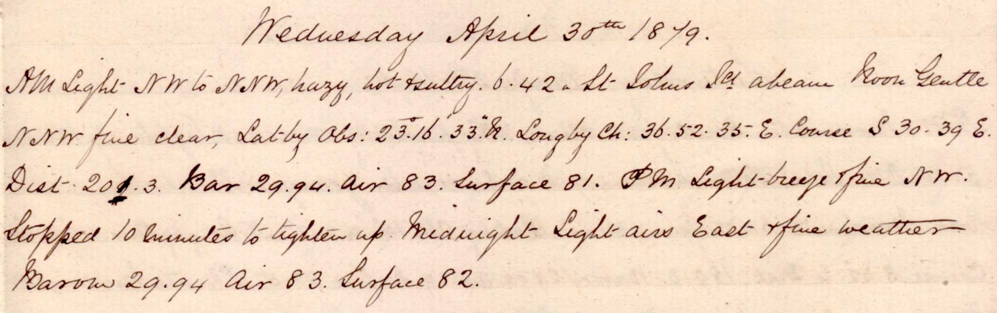 |
click on image to view high resolution version (5x) |
Continuing SE down the Red Sea.
"6.42 St John's Island abeam"
Noon position: N 23° 16' 33" E 36° 52' 35", in the middle of the Red Sea about 350km NW of Mecca.
"PM light breeze & fine NW. Stopped 10 minutes to tighten up."
Thursday, 01 May 1879
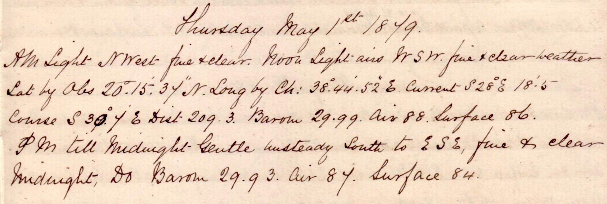 |
click on image to view high resolution version (5x) |
Continuing SE down the Red Sea, in fine weather.
Noon position: N 20°15' 37" E 38° 44' 52", in the middle of the Red Sea about 170km SW of Mecca.
Friday, 02 May 1879
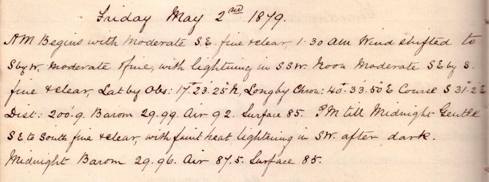 |
click on image to view high resolution version (5x) |
Remark book entry yet to be transcribed.
Saturday, 03 May 1879
 |
click on image to view high resolution version (5x) |
Remark book entry yet to be transcribed.
Sunday, 04 May 1879
 |
click on image to view high resolution version (5x) |
Remark book entry yet to be transcribed.
Monday, 05 May 1879
 |
click on image to view high resolution version (5x) |
Remark book entry yet to be transcribed.
Tuesday, 06 May 1879
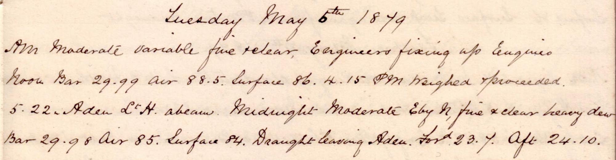 |
click on image to view high resolution version (5x) |
Remark book entry yet to be transcribed.
Wednesday, 07 May 1879
 |
click on image to view high resolution version (5x) |
Remark book entry yet to be transcribed.
Thursday, 08 May 1879
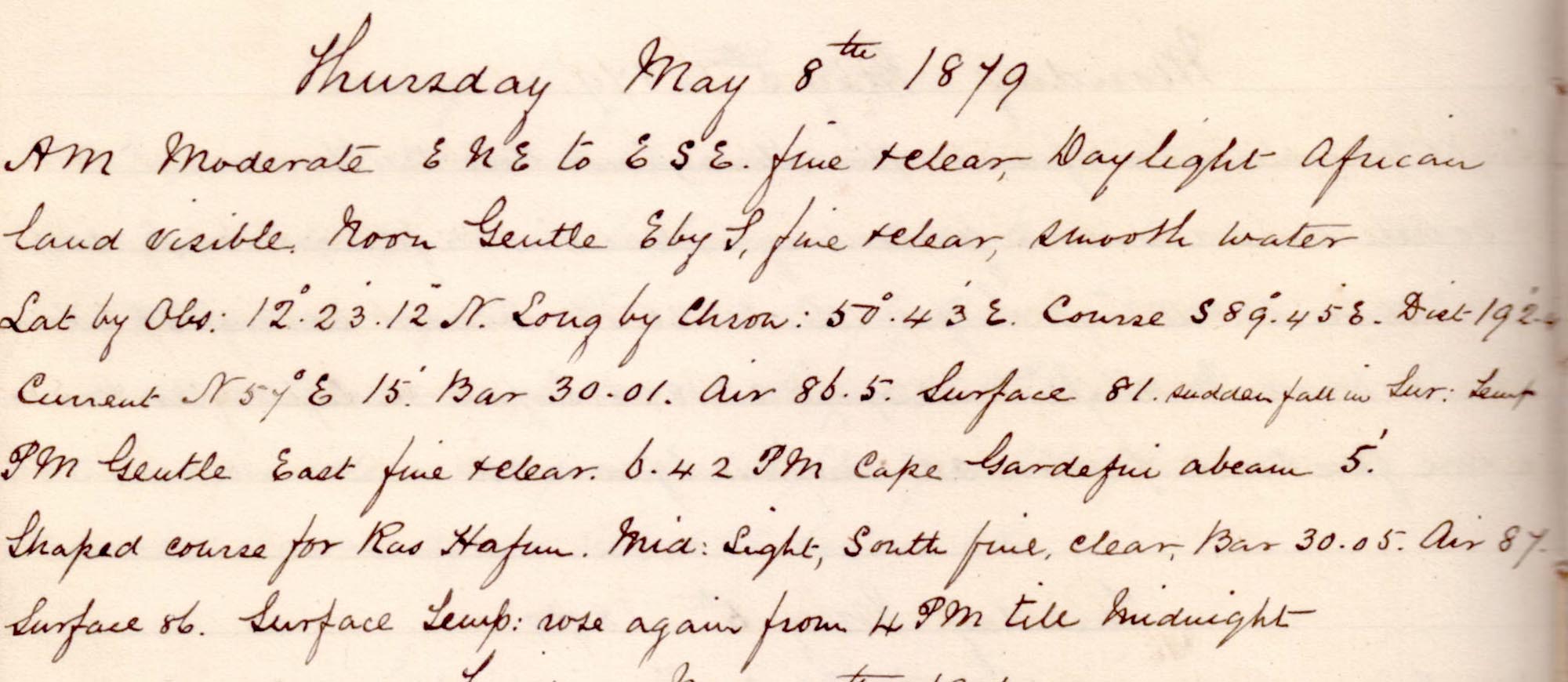 |
click on image to view high resolution version (5x) |
Remark book entry yet to be transcribed.
Friday, 09 May 1879
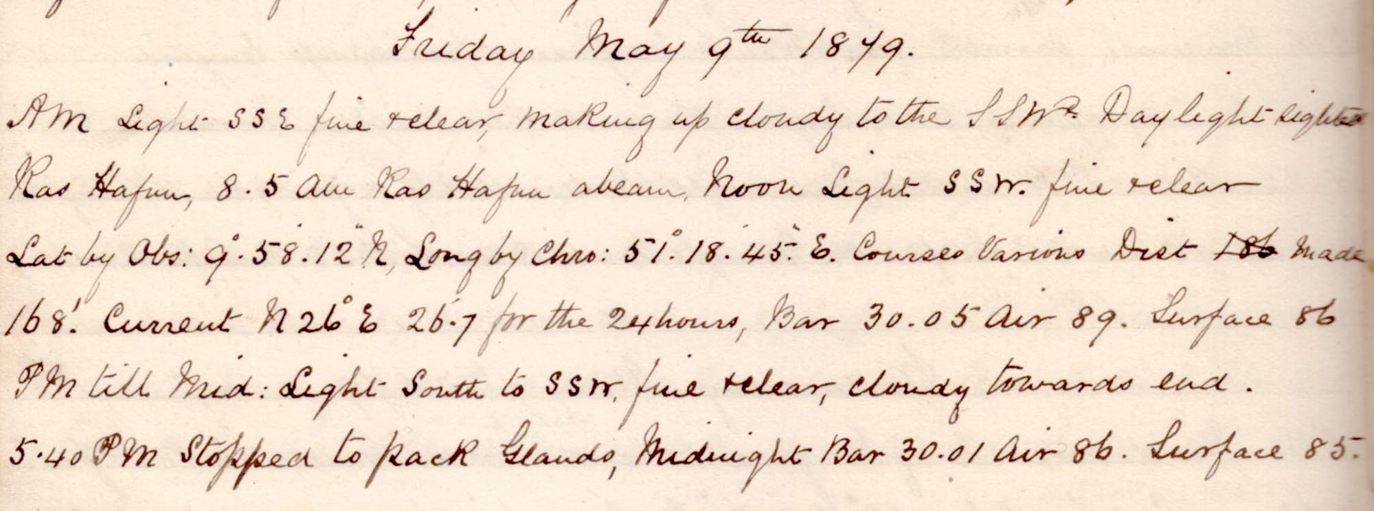 |
click on image to view high resolution version (5x) |
Remark book entry yet to be transcribed.
Saturday, 10 May 1879
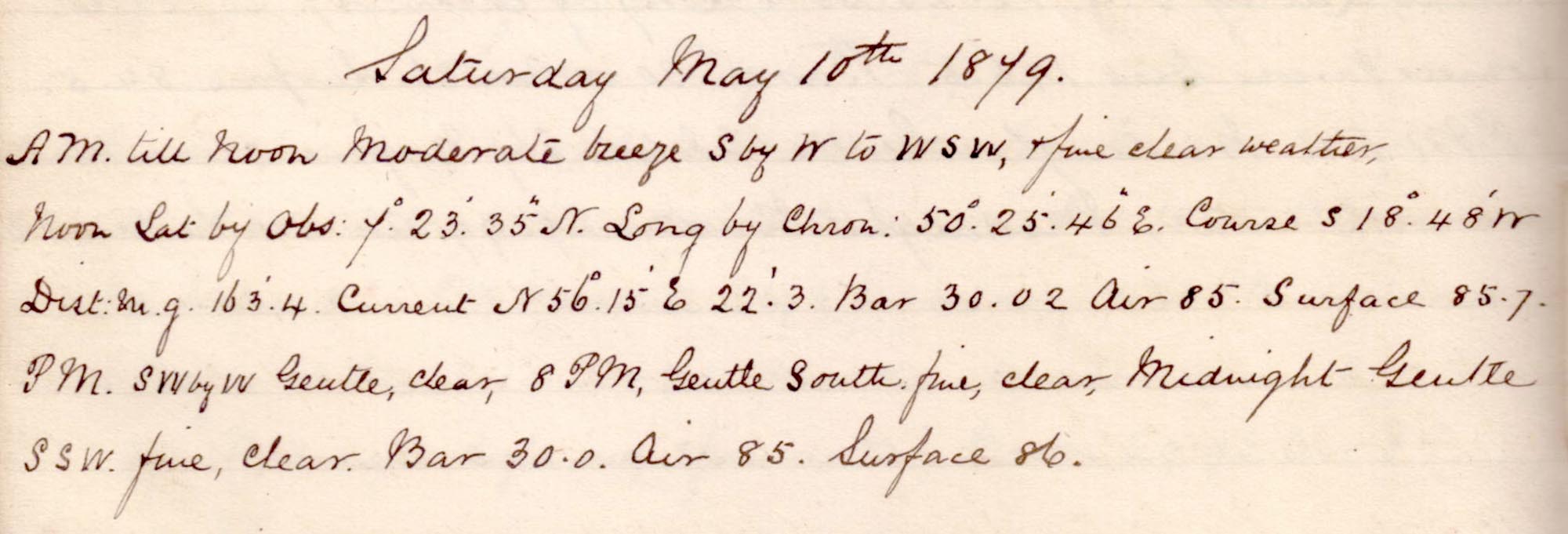 |
click on image to view high resolution version (5x) |
Remark book entry yet to be transcribed.
Sunday, 11 May 1879
 |
click on image to view high resolution version (5x) |
Remark book entry yet to be transcribed
Monday, 12 May 1879
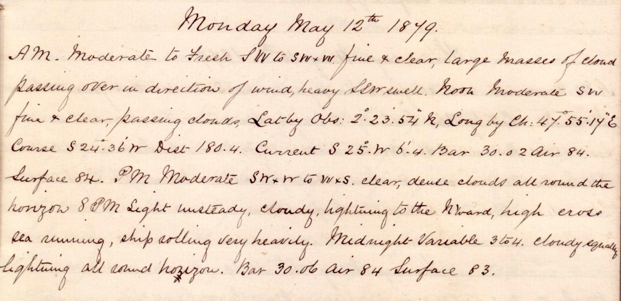 |
click on image to view high resolution version (5x) |
Remark book entry yet to be transcribed.
Tuesday, 13 May 1879
 |
click on image to view high resolution version (5x) |
Remark book entry yet to be transcribed.
Wednesday, 14 May 1879
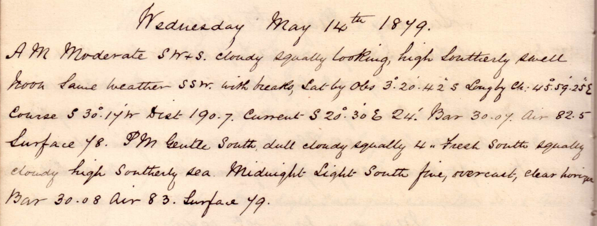 |
click on image to view high resolution version (5x) |
Remark book entry yet to be transcribed.
Thursday, 15 May 1879
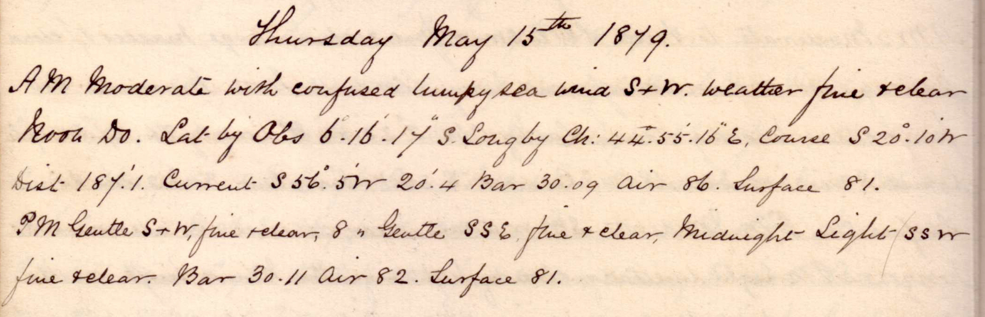 |
click on image to view high resolution version (5x) |
Remark book entry yet to be transcribed.
Friday, 16 May 1879
|
click on image to view high resolution version (5x) |
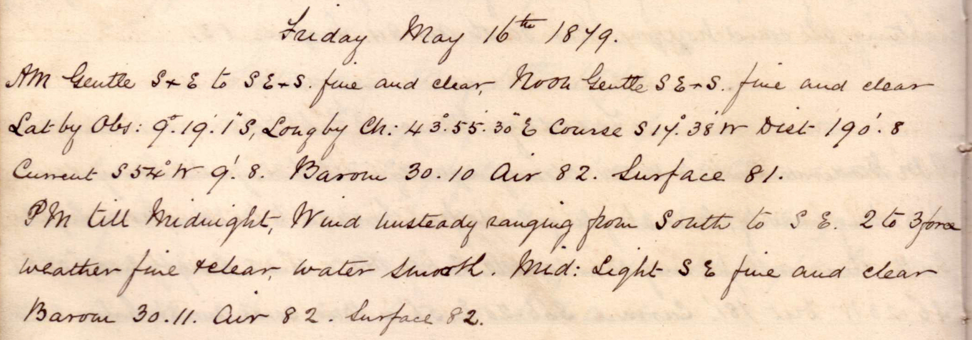
Remark book entry yet to be transcribed.
Saturday, 17 May 1879
 |
click on image to view high resolution version (5x) |
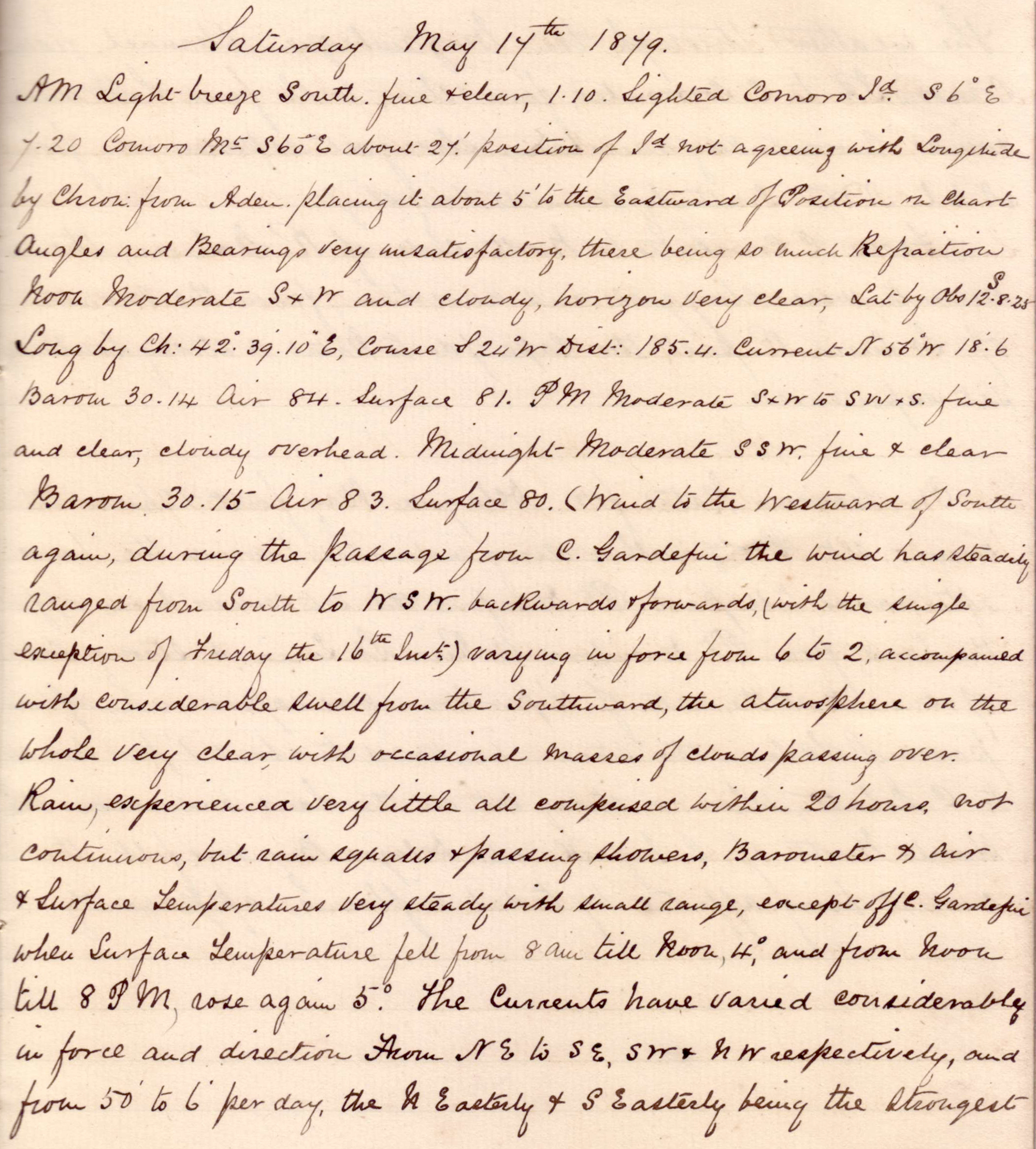
Comoro Island (Comoros) and the Mozambique Channel.
AM "1.10 Sighted Comoro Island S36°E, 7.20 Comoro Mt S60°E about 27'. Position of Island not agreeing with Longitude by Chron from Aden. Placing it about 5' to the Eastward of Position on chart. Angles and Bearings very unsatisfactory, there being so much Refraction."
Noon position: S 12° 8' 25" E 42° 39' 10", about 80km SW Comoros Island.
"Midnight. Moderate SSW. fine & clear. Barom 30.15 Air 83 Surface 80 (Wind to the Westward of South again, during the passage from C. Gardefui[?] the wind has steadily changed from South the WSW. backwards & forwards, (with the single exception of Friday the 16th Inst) verying in force from 6 to 2, accompanied with considerable swell from the Southward, the atmosphere on the whole very clear, with occasional masses of clouds passing over."
 |
click on image to view high resolution version (5x) |
Sunday, 18 May 1879
click on image to view high resolution version (5x) |

Noon position: S 15° 14' 2" E 41° 39' 57", in the Mozambique Channel about 100km offshore from Moçambique.
Monday, 19 May 1879
click on image to view high resolution version (5x) |
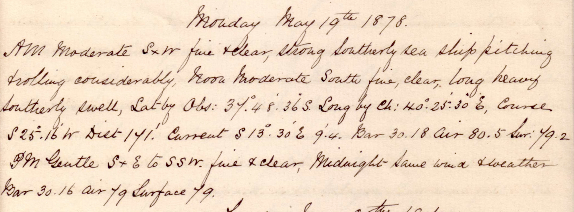
Noon position: S 37° [sic ... 17° much more likely] 48' 36" E 40° 25' 30", in the middle of the Mozambique Channel about 300km S of Moçambique.
Tuesday, 20 May 1879
click on image to view high resolution version (5x) |
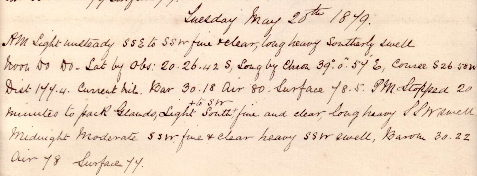
Noon position: S 20° 26' 42" E 39° 0' 57", in the middle of the Mozambique Channel about 450km E of Beira.
Wednesday, 21 May 1879
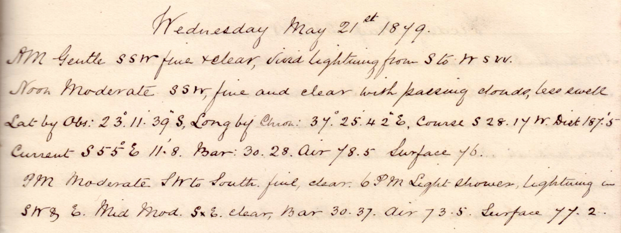 |
click on image to view high resolution version (5x) |
Remark book entry yet to be transcribed.
Thursday, 22 May 1879
 |
click on image to view high resolution version (5x) |
Remark book entry yet to be transcribed.
Friday, 23 May 1879
 |
click on image to view high resolution version (5x) |
Remark book entry yet to be transcribed.
 |
||
 |
 |
 |
| click on image to view high resolution version (10x) | ||
| Soundings taken during the voyage to Natal, on 1st section of the Cape Cable. Commenced off Inyack Island (Inhaca Island) - Delagoa Bay (Maputo Bay). |
||
|
| click on image to view high resolution version (5x) |
| This graph is the result of the swinging the ship round the compass manoeuvre: "Black ink (line), swung off Cape Inyack (Inhaca), loaded, Lat 26° South. Long 33°.0 East. 23.5.79." Other two lines from previous "swingings" on 25 April and 13 July 1879. |
Saturday, 24 May 1879
 |
click on image to view high resolution version (5x) |
Remark book entry yet to be transcribed.
Sunday, 25 May 1879
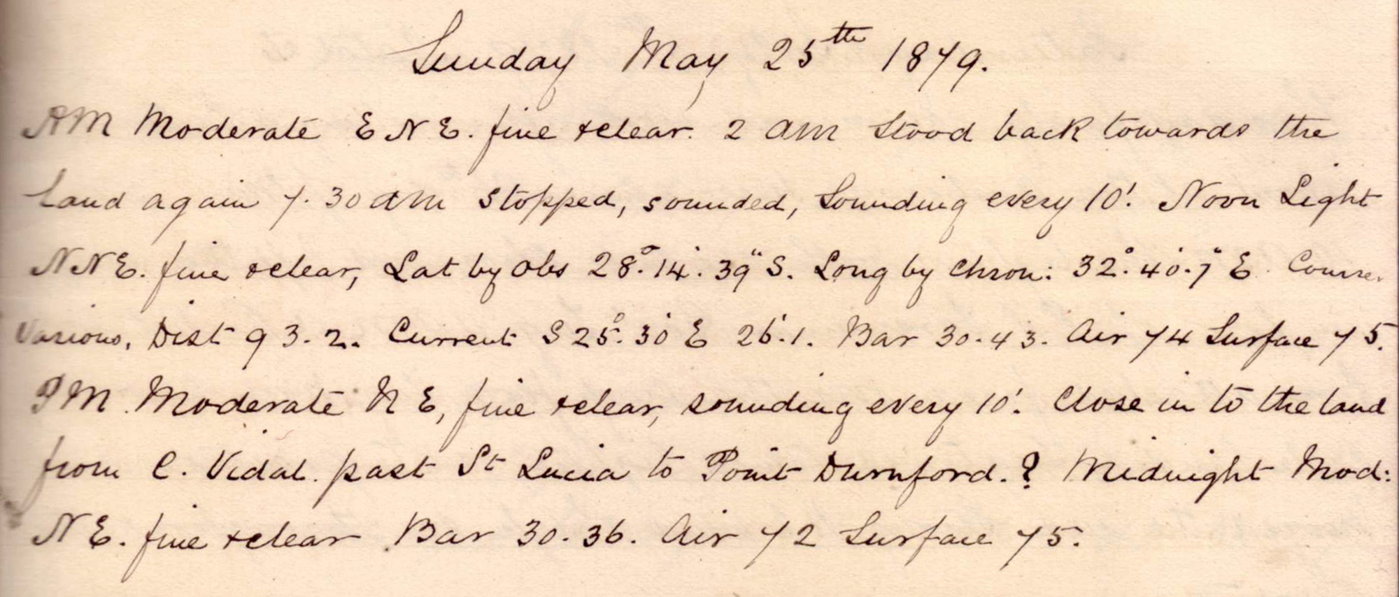 |
click on image to view high resolution version (5x) |
Remark book entry yet to be transcribed.
Monday, 26 May 1879
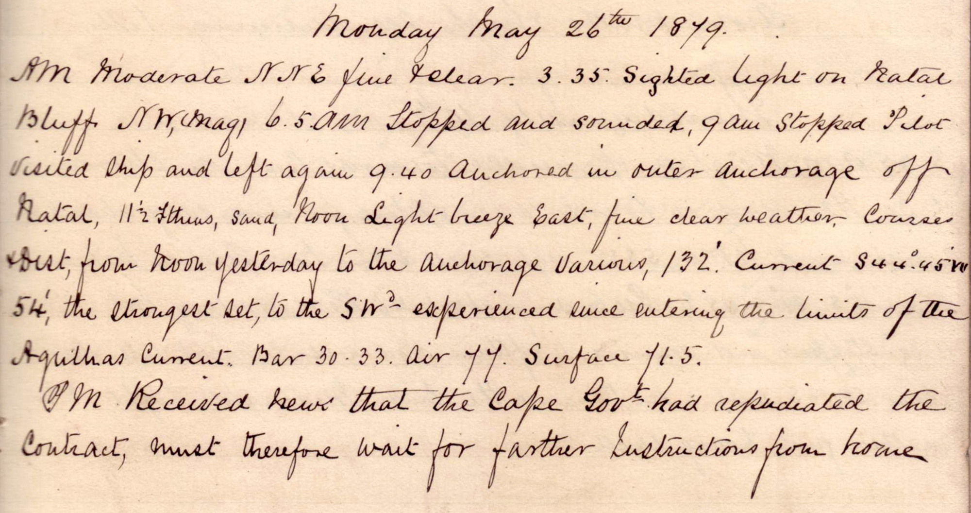 |
click on image to view high resolution version (5x) |
Arrival at Natal (Natal is now the KwaZulu-Natal province of South Africa, and the Port of Natal is now the Port of Durban).
"3.35am Sighted light on Natal Bluff." "6.5am Stopped and sounded, 9am stopped Pilot visited ship and left again. 9.40 anchored in outer anchorage off Natal."
"PM. Received news that the Cape government had repudiated the contract, must therefore wait for further instructions from home."
Tuesday, 27 May 1879 - Friday, 04 July 1879
No entries in the Remark Book. Likely 5 weeks at anchor in Natal while contract negotiations continue between the Company and the Cape government.
Saturday, 05 July 1879
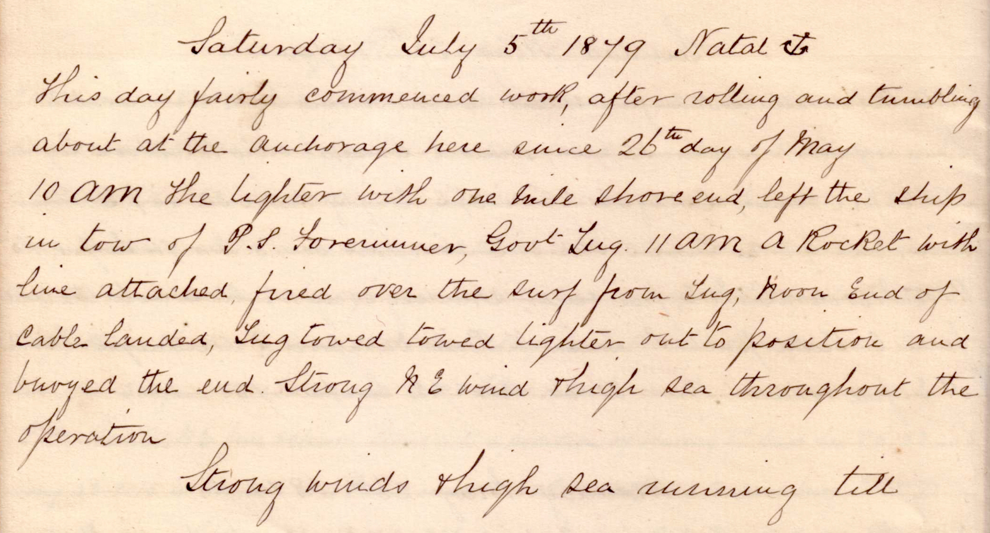 |
click on image to view high resolution version (5x) |
Starting cable laying work in Natal Harbour.
"This day fairly commenced work, after rolling and tumbling about at the anchorage here since 26th day of May."
"10am the lighter with one mile shore end, left the ship in tow of PS Forerunner, Govt tug. 11am a rocket with line attached fired over the surf from tug; Noon, end of cable landed, tug towed towed [sic] lighter out to position and buoyed the end. Strong NE wind & high sea throughout the operation."
"Strong winds & high sea [??] till ..."
Sunday, 06 July 1879 - Wednesday, 09 July 1879.
No entries in the Remark Book, probably postponing operations due to the strong winds and high sea.
Thursday, 10 July 1879
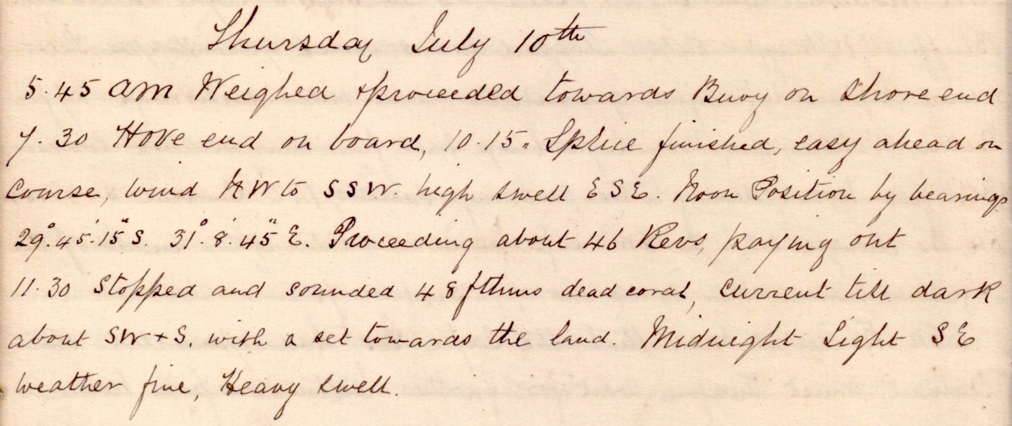 |
click on image to view high resolution version (5x) |
Make connection with shore end of cable and start laying cable to N of Natal.
"5.45am Weighed & proceeded towards buoy on shore end. 7.30 Hove end on board, 10.15 Splice finished, easy ahead on course."
Noon position: S 29° 45' 15" E 31° 8' 45", approximately 18km NNE of Natal (Durban) Harbour.
"Proceeding about 46Revs paying out. 11.30 stopped and sounded 48 fathoms dead coral, current till dark about SW+S, with a set towards the land."
Friday, 11 July 1879
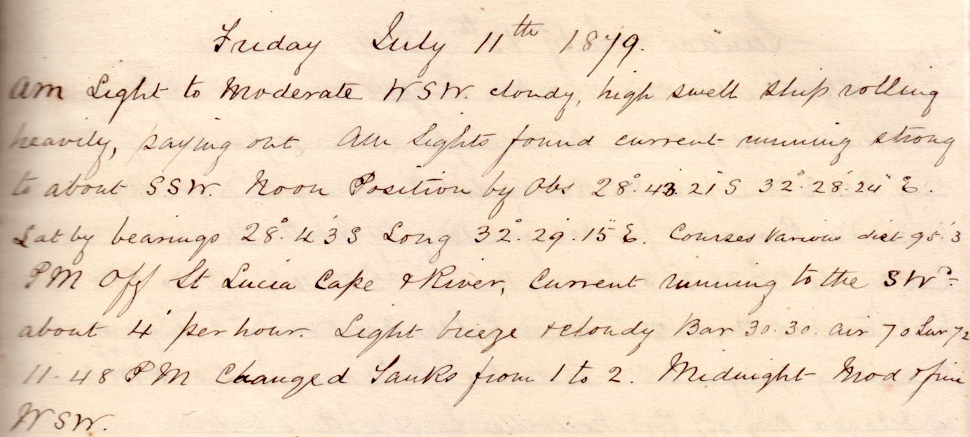 |
click on image to view high resolution version (5x) |
"Ship rolling heavily, paying out."
Noon position: S 28° 43' E 32° 29' 15", 200km NE of Natal and approximately 20km offshore.
"PM Off St Lucia Cape & River, Current running to the SW - about 4' per hour." "11.48pm Changed tanks from 1 to 2."
Saturday, 12 July 1879
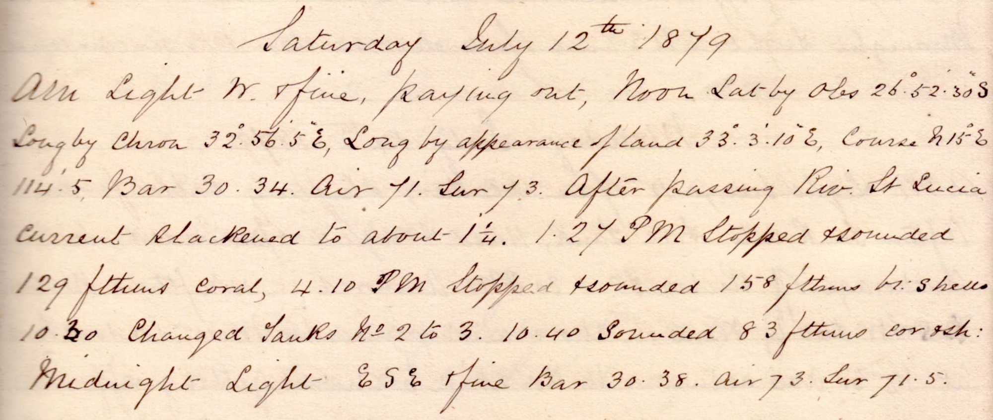 |
click on image to view high resolution version (5x) |
"Paying out."
Noon position: S 26° 52' 30" E 32° 56' 5" by chronometer (and E 33° 3' 10" by appearance of land),
"1.27pm Stopped and sounded 129 fathoms coral, 4.10pm Stopped and sounded 158 fathoms br shells. 10.30 changed tanks No 2 to 3. 10.40 sounded 83 fathoms coral & shells."
Sunday, 13 July 1879
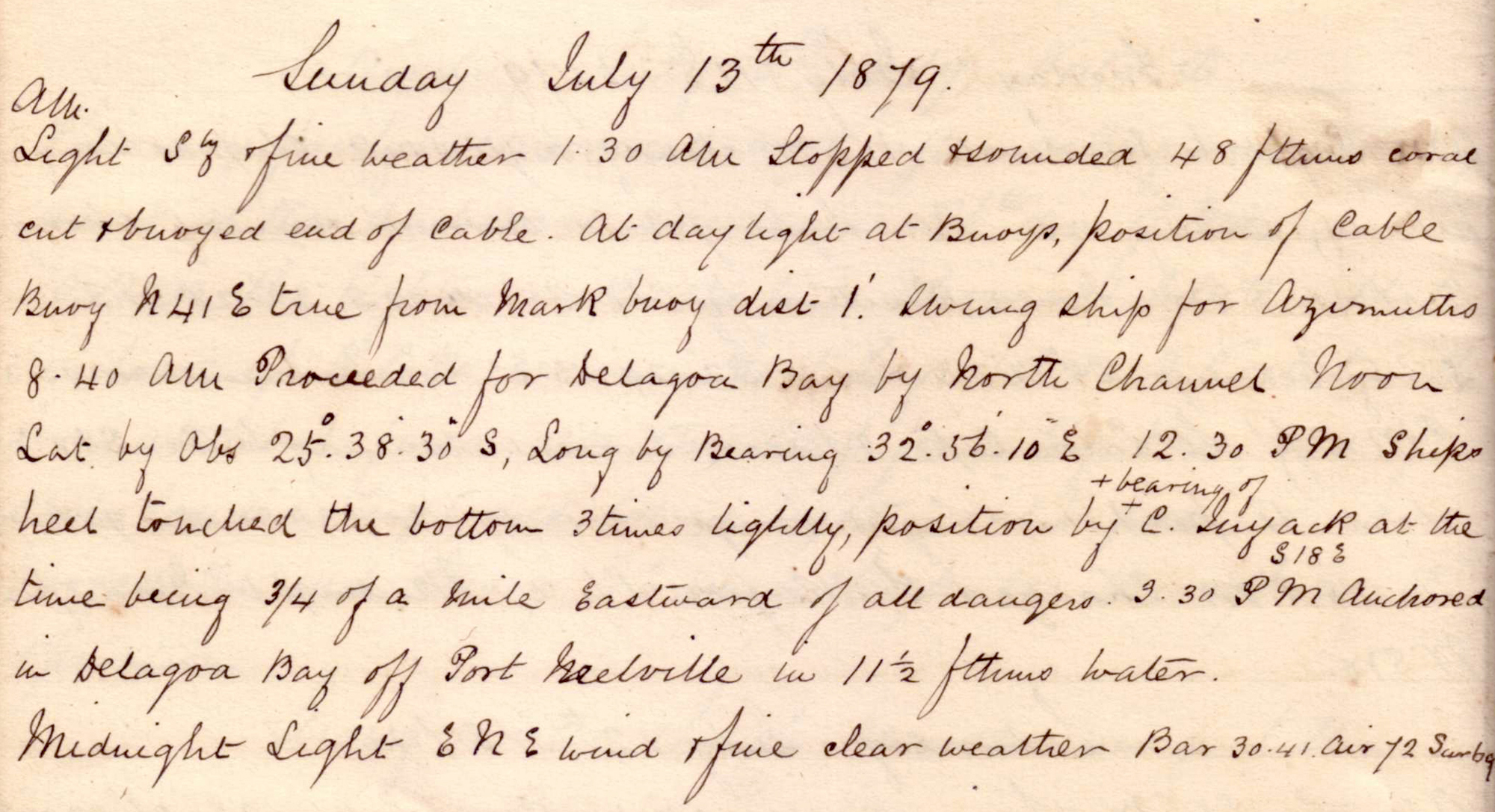 |
click on image to view high resolution version (5x) |
Completed cable run, buoyed the free end of cable, and returned to port.
"1.30 am Stopped & sounded 48 fathoms coral. Cut & buoyed end of cable. At daylight at buoys, position of cable buoy N41°E true from mark buoy, distance 1'. Swung ship for azimuths."
|
| click on image to view high resolution version (5x) |
This graph is the result of the swinging the ship round the compass manoeuvre: "Red ink (line), swung off Cape Inyack (Inhaca), Ballast trim, Lat 26° South. Long 33°.0 East. 13.7.79." Other two lines from previous "swingings" on 25 April and 23 May 1879. |
"8.40am Proceeded for Delagoa Bay by North Channel."
Noon position: S25° 38' 30" E 32° 56' 10", about 50km NNE of Delagoa (Maputo) Bay.
"12.30pm Ships heel touched the bottom 3 times lightly, position by bearing of C Inyack at the time being 3/4 of a mile Eastward of all dangers."
"3.30pm anchored in Delagoa Bay off Port Melville in 11 1/2 fathoms water."
Monday, 14 July 1879
 |
click on image to view high resolution version (5x) |
Shifting cable and going ashore.
"Shifting cable from after tank into fore tank. 11.40am Weighed & proceeded to anchorage off Reuben Point. 1.30pm Anchored in 4 1/2 fathoms." "Went on shore accompanied by Messrs London (Thomas London, Electrician) & Ford (Possibly telegraph Engineer Thomas Alfred Forde) at 12.30 and returned to the ship 6 1/2 hours getting off."
Tuesday, 15 July 1879
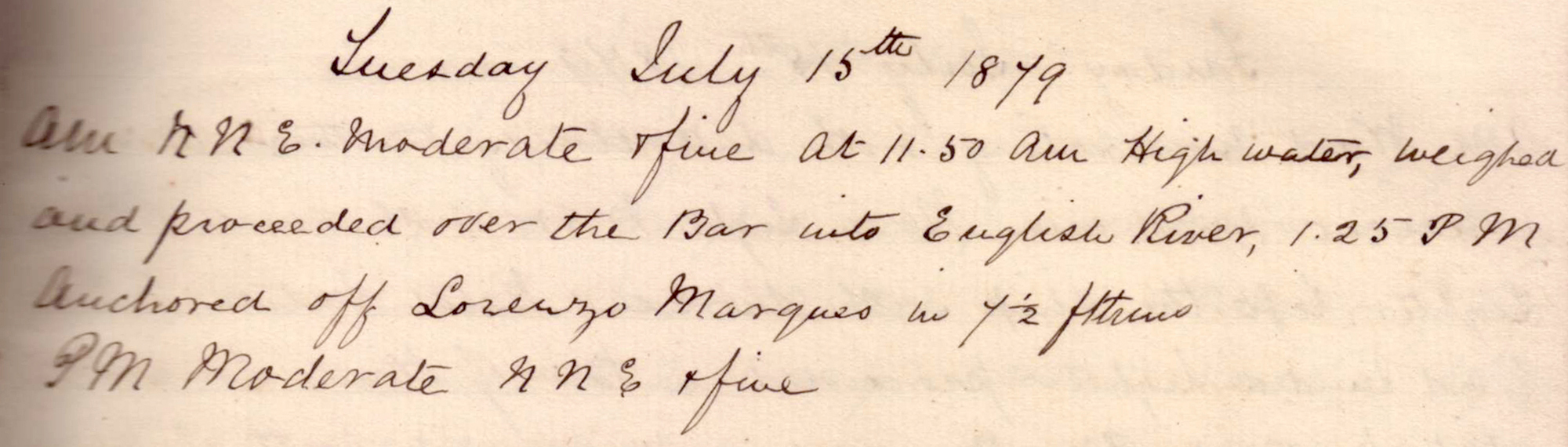 |
click on image to view high resolution version (5x) |
"At 11.50am high water, weighed and proceeded over the Bar into English River, 1.25pm Anchored off Lourenço Marques (now Maputo, the capital of Mozambique) in 7 1/2 fathoms."
Wednesday, 16 July 1879
 |
click on image to view high resolution version (5x) |
Laying Mozambique shore end of cable.
"Daylight commenced coiling 2 1/2 miles shore-end Mozambique section into lighter. 10.45am Lighter left for the cable house towed by steam launch loaned from HM[?]M Corvette "Reina da Portugal" Captain [?]Cabral. 1.30 End of cable in cable house, lighter started in tow paying out. 3.30pm Buoyed end in 23ft water outside Reuben Point."
Thursday, 17 July 1879
 |
click on image to view high resolution version (5x) |
Prepare Natal shore-end cable segment and wait due weather.
"Commenced coiling 2 1/2 miles Natal section shore end in lighter. 8.45am Finished coiling in lighter. Too much wind & sea to lay the cable."
Friday, 18 July 1879
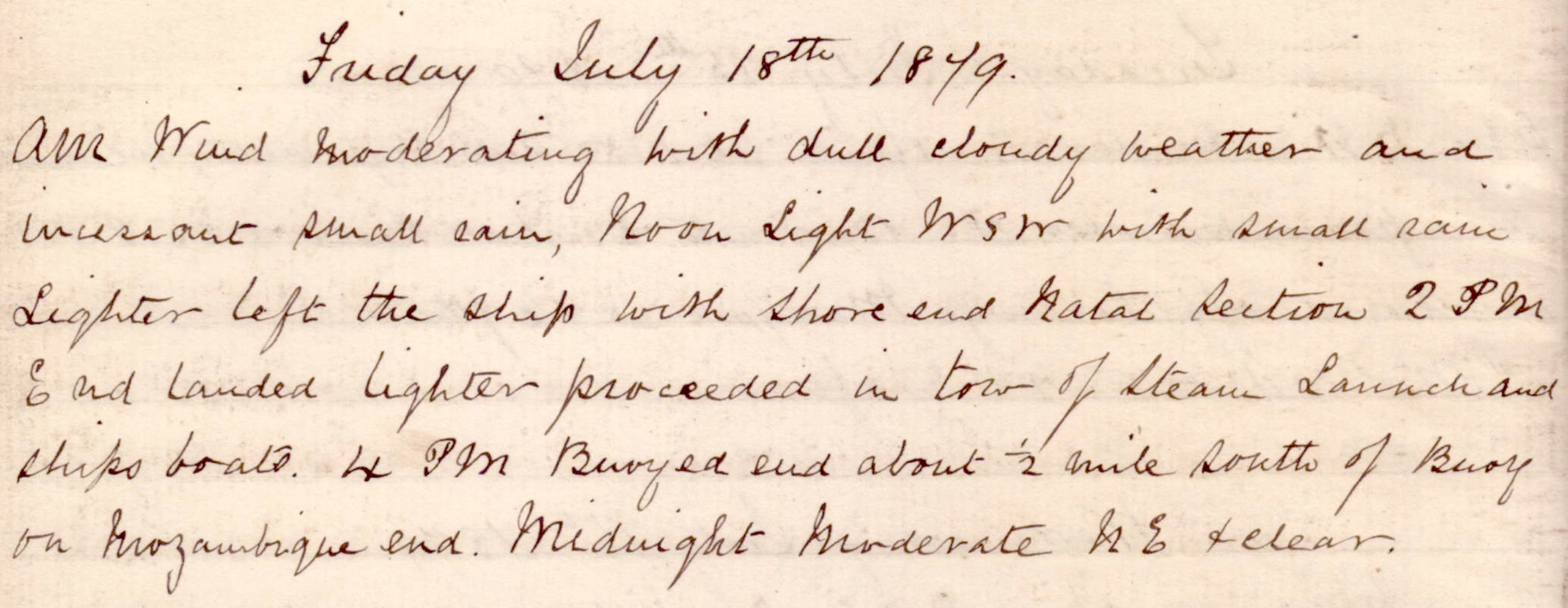 |
click on image to view high resolution version (5x) |
"Weather moderating." "Noon. Light WSW with small rain. Lighter left the ship with shore end Natal section. 2pm End landed lighter proceeded in tow of Steam launch and ships boats. 4pm Buoyed en about 1/2 mile South of buoy on Mozambique end."
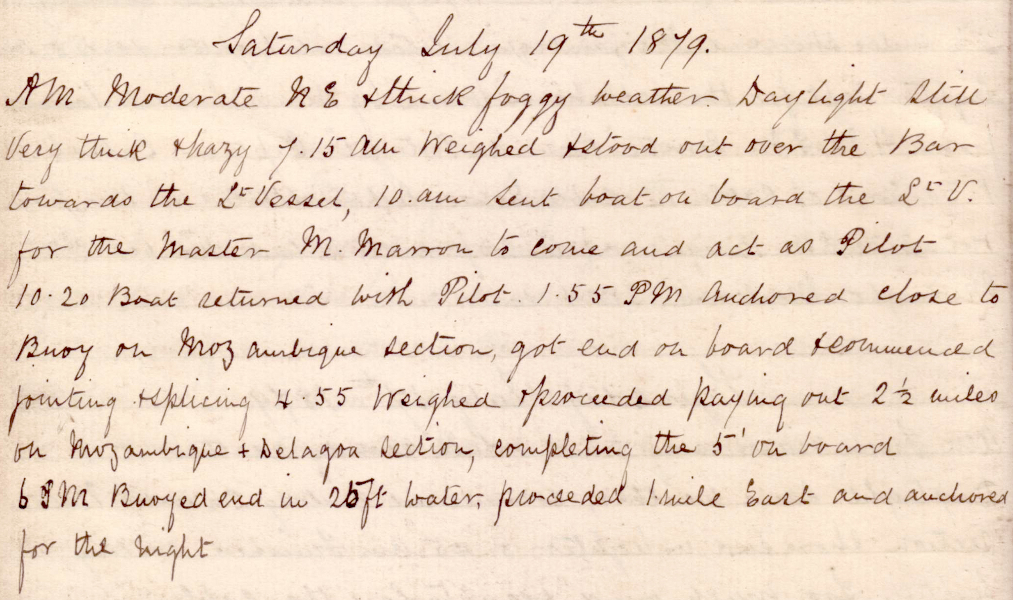
Saturday, 19 July 1879
 |
click on image to view high resolution version (5x) |
"7.15am Weighed & stood out over the Bar towards the Light Vessel. 10am Sent boat on board the St V for the Master M Marron to come and act as Pilot. 10.20 Boat returned with Pilot. 1.55pm Anchored close to buoy on Mozambique section, got end on board & commenced jointing and splicing. 4.55pm weighed & proceeded paying out 2 1/2 miles on Mozambique & Delagoa section, completing the 5' on board. 6pm buoyed end in 25ft water, proceeded 1 mile East and anchored for the night."
Sunday, 20 July 1879
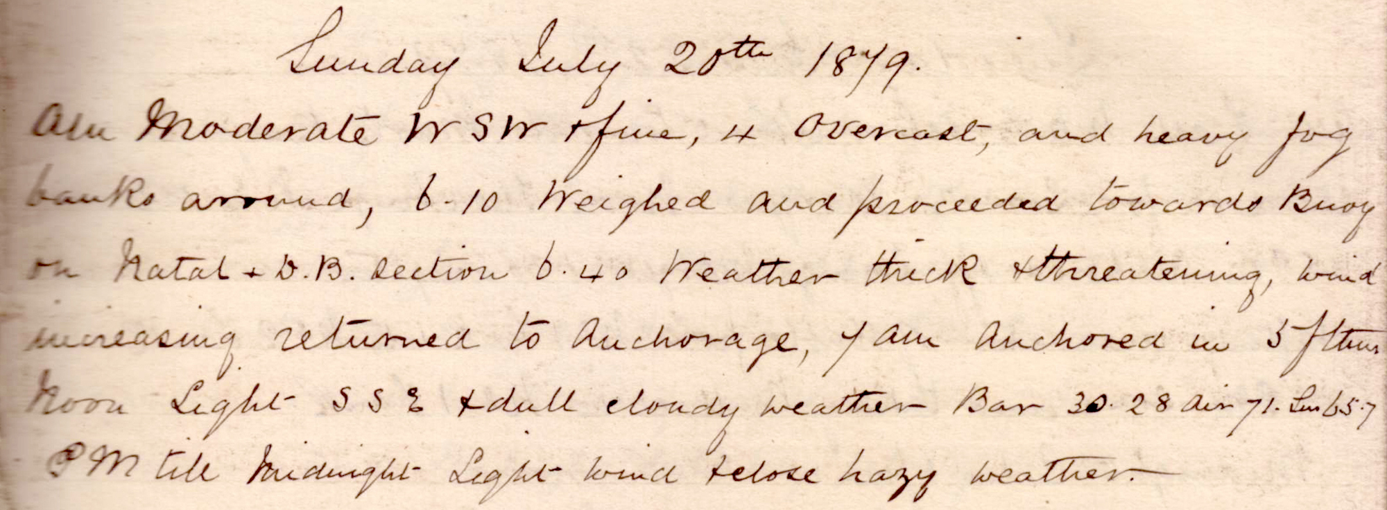 |
click on image to view high resolution version (5x) |
"6.10am Weighed and proceeded towards buoy on Natal & Delagoa Bay section. 6.40am Weather thick & threatening, wind increasing, returned to anchorage. 7am anchored in 5 fathoms."
Monday, 21 July 1879
 |
click on image to view high resolution version (5x) |
"5.45am Weighed & proceeded towards buoy on Nat DB section. 7.10am Stopped at buoy, got end on board & commenced jointing & splicing. 9.10am Splice finished, proceeded easy paying out. 12.5pm Passed St V. fresh breeze NNE & fine steering to the North & Eastward through the [?]Cooktown Channel towards buoy on end outside shoals. 2.32pm Sighted buoy. 4.15pm At buoy. 4.25pm En on board, commenced jointing and splicing. 6.45pm Splice finished. Slipped final splice and bight of Natal & Delagoa Section OK. Stood off to the Eastward slow."
Tuesday, 22 July 1879
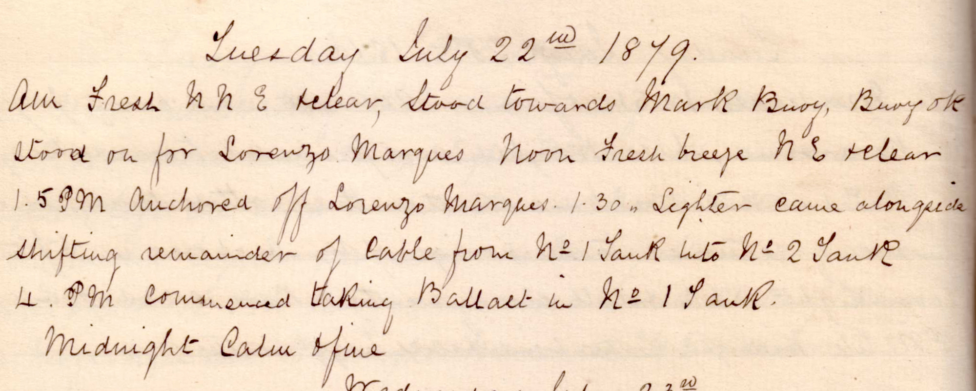 |
click on image to view high resolution version (5x) |
"Stood towards Mark Buoy, Buoy OK. Stood on for Lourenço Marques." "1.5pm Anchored off Lourenço Marques. 1.30pm Lighter came alongside shifting remainder of cable from No 1 tank into No 2 tank. 4pm Commenced taking ballast in No 1 tank."
Wednesday, 23 July 1879
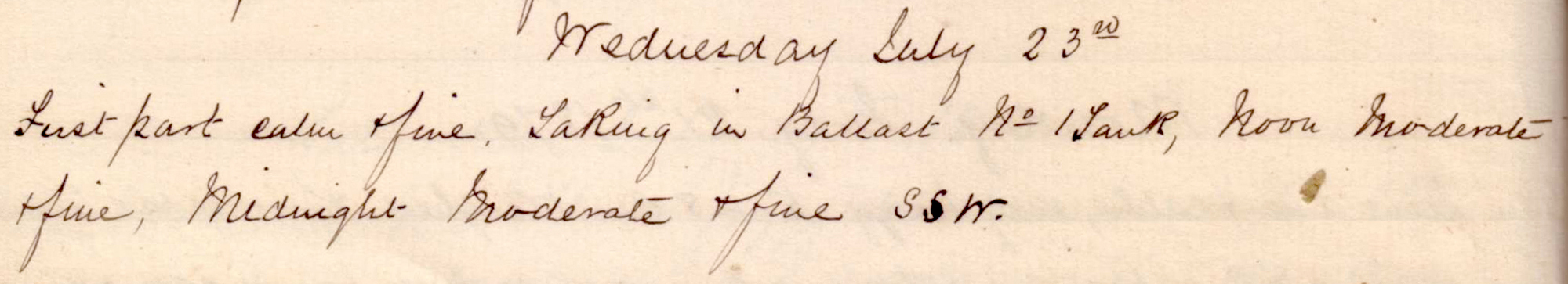 |
click on image to view high resolution version (5x) |
"Taking in ballast No 1 tank."
Thursday, 24 July 1879
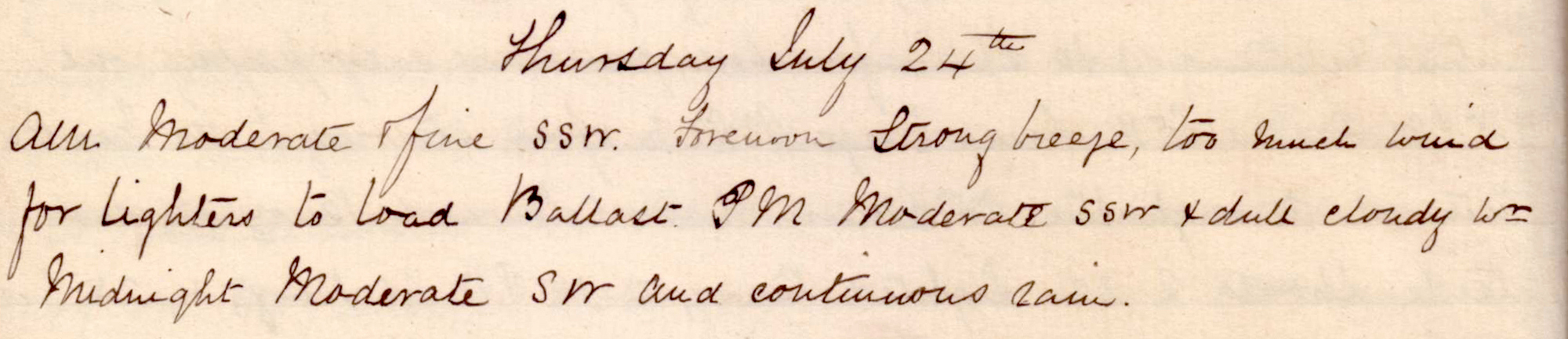 |
click on image to view high resolution version (5x) |
"... too much wind for lighter to load Ballast."
Friday, 25 July 1879
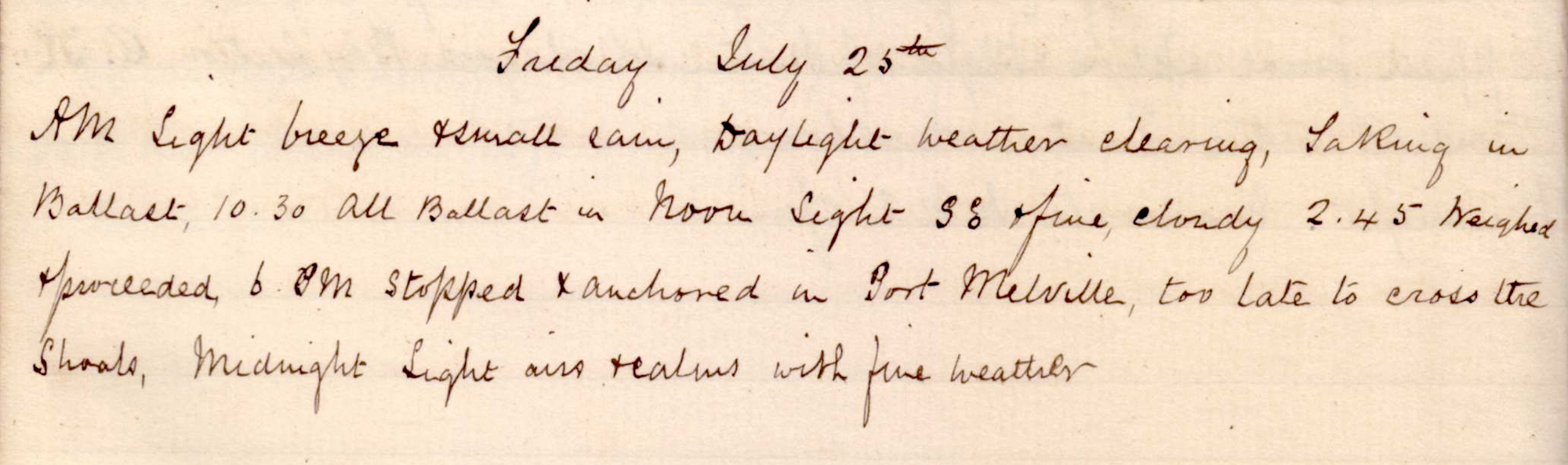 |
click on image to view high resolution version (5x) |
"Taking in Ballast. 10.30am All Ballast in."
"2.45pm Weighed & proceeded. 6pm Stopped & anchored in Port Melville, too late to cross the shoals."
Saturday, 26 July 1879
 |
click on image to view high resolution version (5x) |
"6.35am Weighed & proceeded. 10.15am Alongside mark buoy off C Inyack. Steered North true 17 1/2 miles to place buoy to start soundings [??]. 0.25pm Stopped, sounded 34 fathoms coral. placed mark buoy S 25 35' 30" E 33° 8' 15", 0.50pm Proceeded towards Mozambique on cable line sounding every 10', see table of soundings & positions at the end of Book."
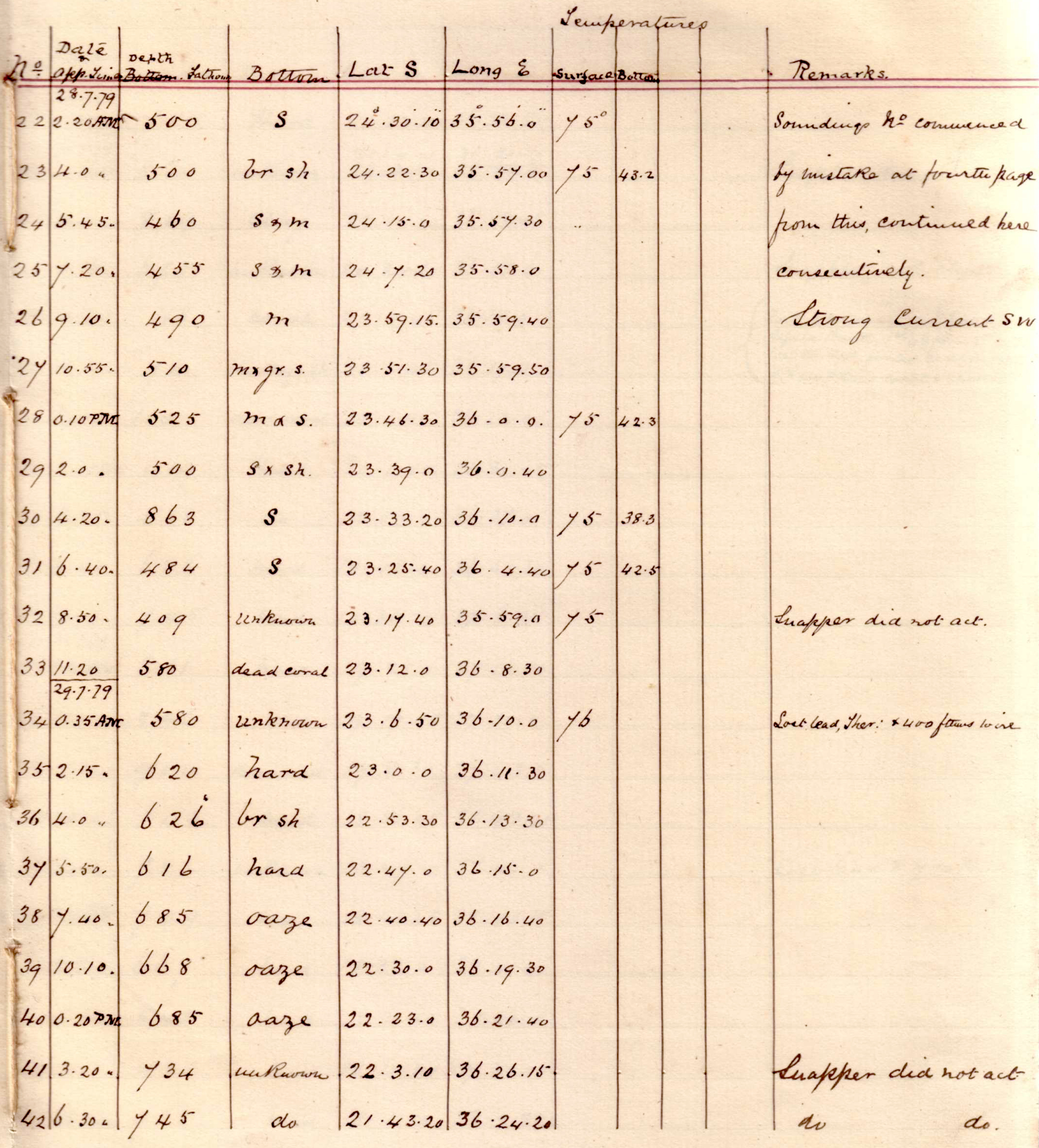
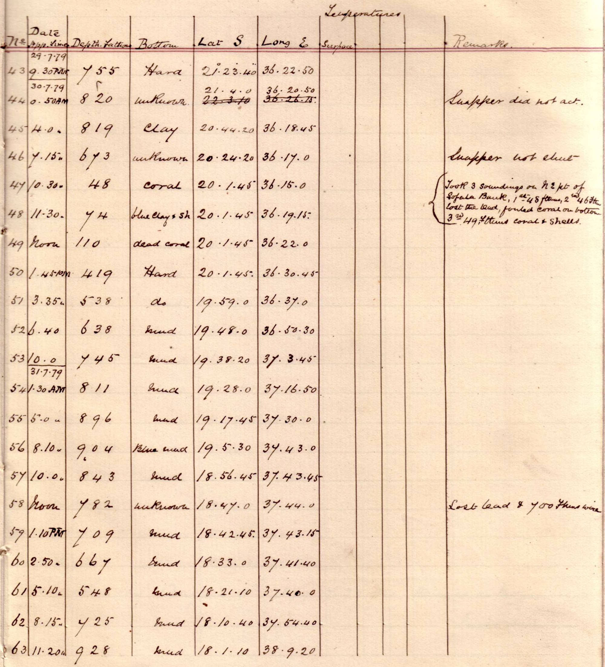
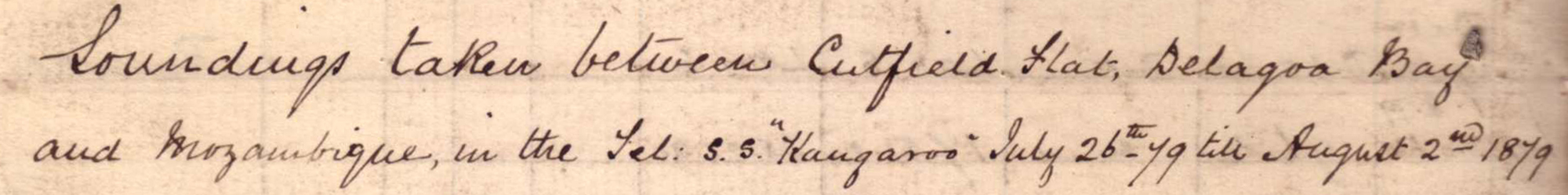 |
 |
| click on image to view high resolution version (5x) |
| Soundings taken between Cutfield Flat, Delagoa Bay and Mozambique. |
Sunday, 27 July 1879
 |
click on image to view high resolution version (5x) |
"Sounding every 10'."
Noon position: S 25° 23' 3" E 35° 25' 18".
Monday, 28 July 1879
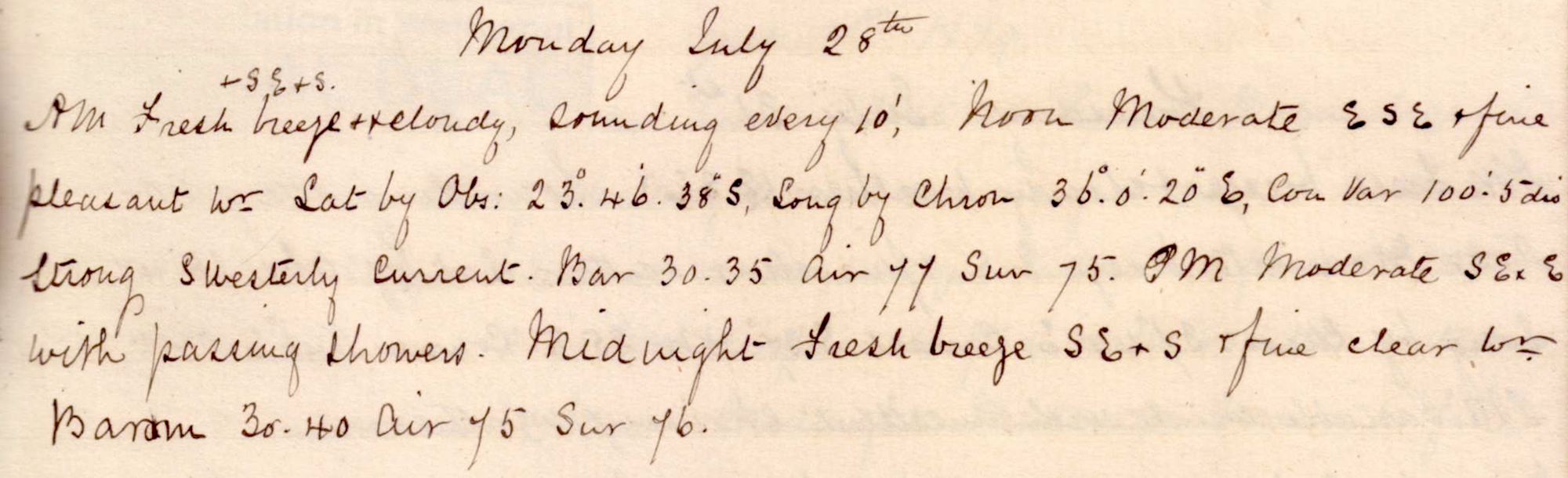 |
click on image to view high resolution version (5x) |
"Sounding every 10'."
Noon position: S 23° 46' 38" E 36 °0' 20".
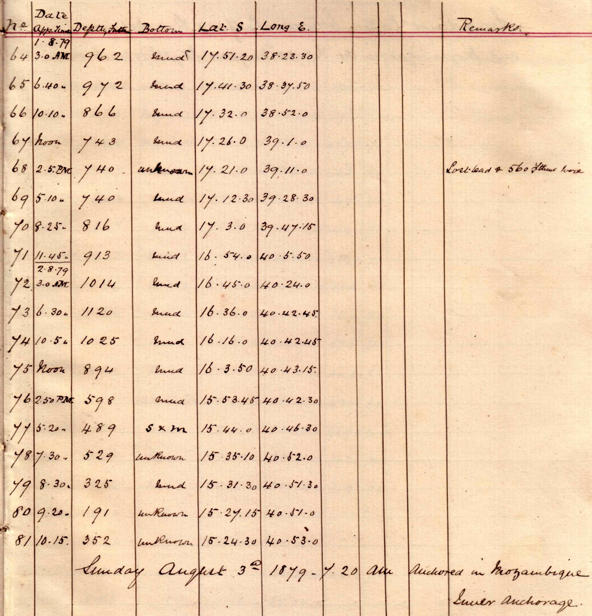
 |
||
 |
 |
 |
click on image to view high resolution version (10x) |
||
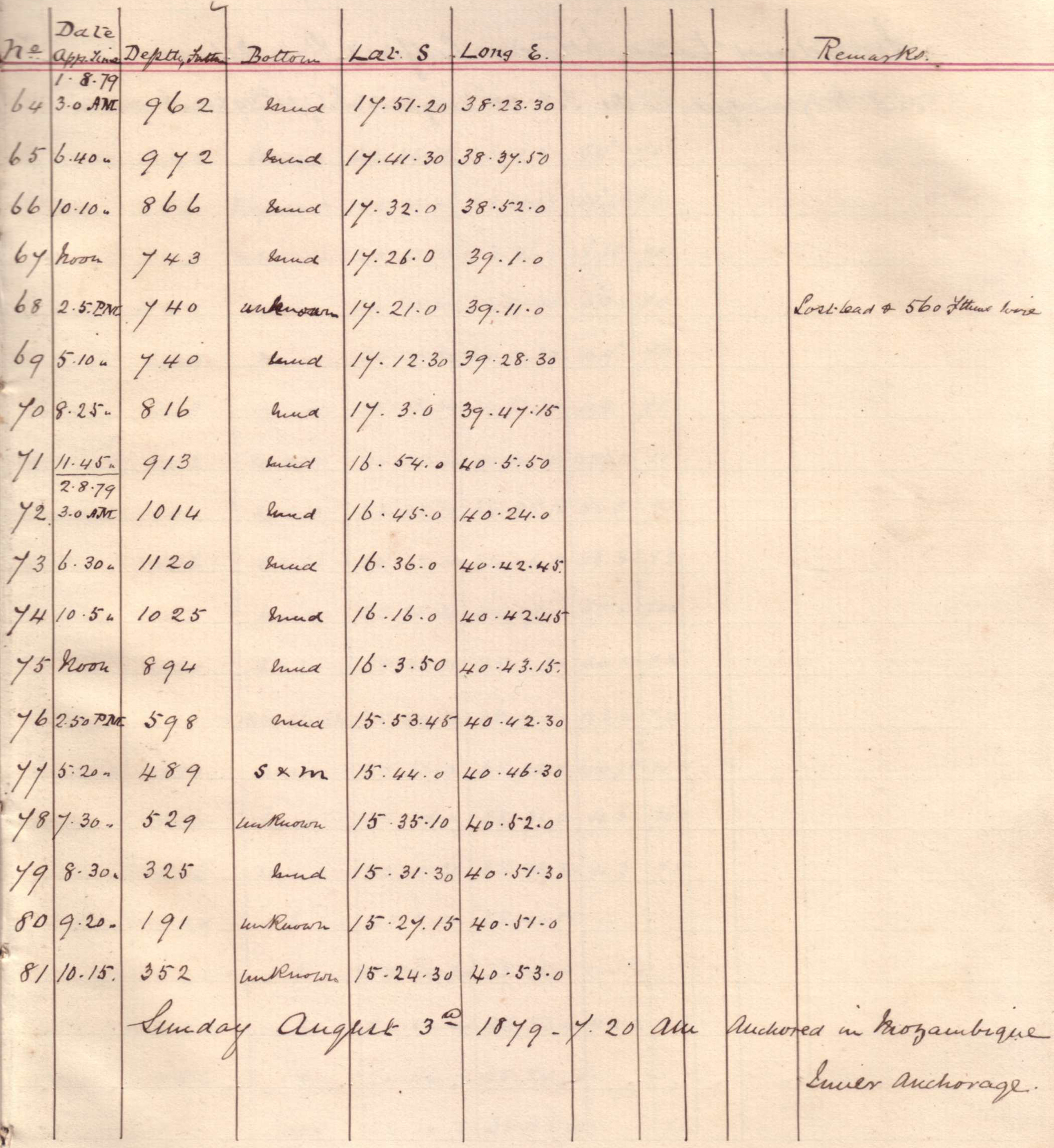
Soundings taken between Delagoa Bay and Mozambique. |
||
Tuesday, 29 July 1879
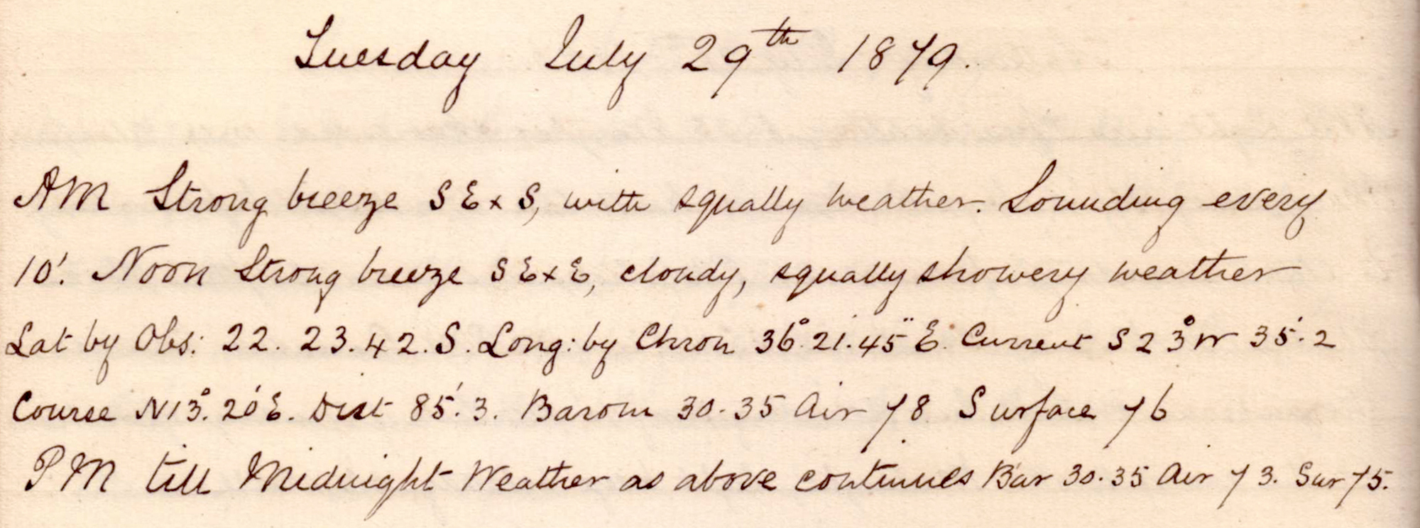 |
click on image to view high resolution version (5x) |
Remark book entry yet to be transcribed.
Wednesday, 30 July 1879
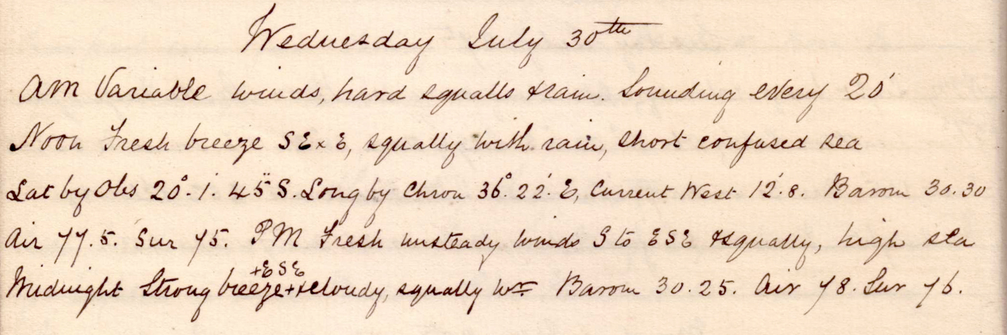 |
click on image to view high resolution version (5x) |
Remark book entry yet to be transcribed.
Thursday, 31 July 1879
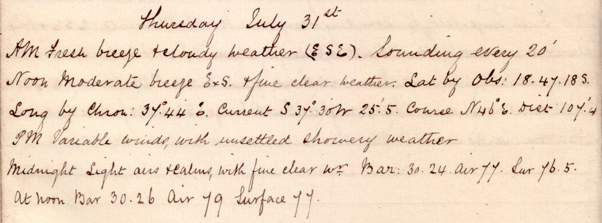 |
click on image to view high resolution version (5x) |
Remark book entry yet to be transcribed.
Friday, 01 August 1879
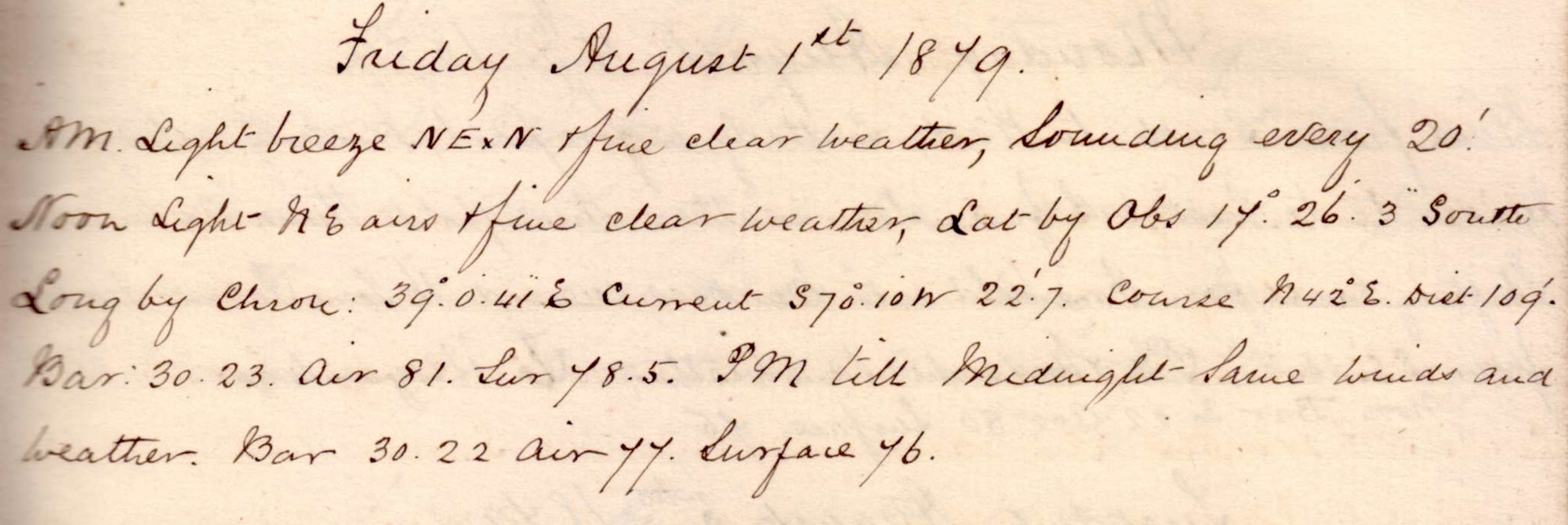 |
click on image to view high resolution version (5x) |
Remark book entry yet to be transcribed.
Saturday, 02 August 1879
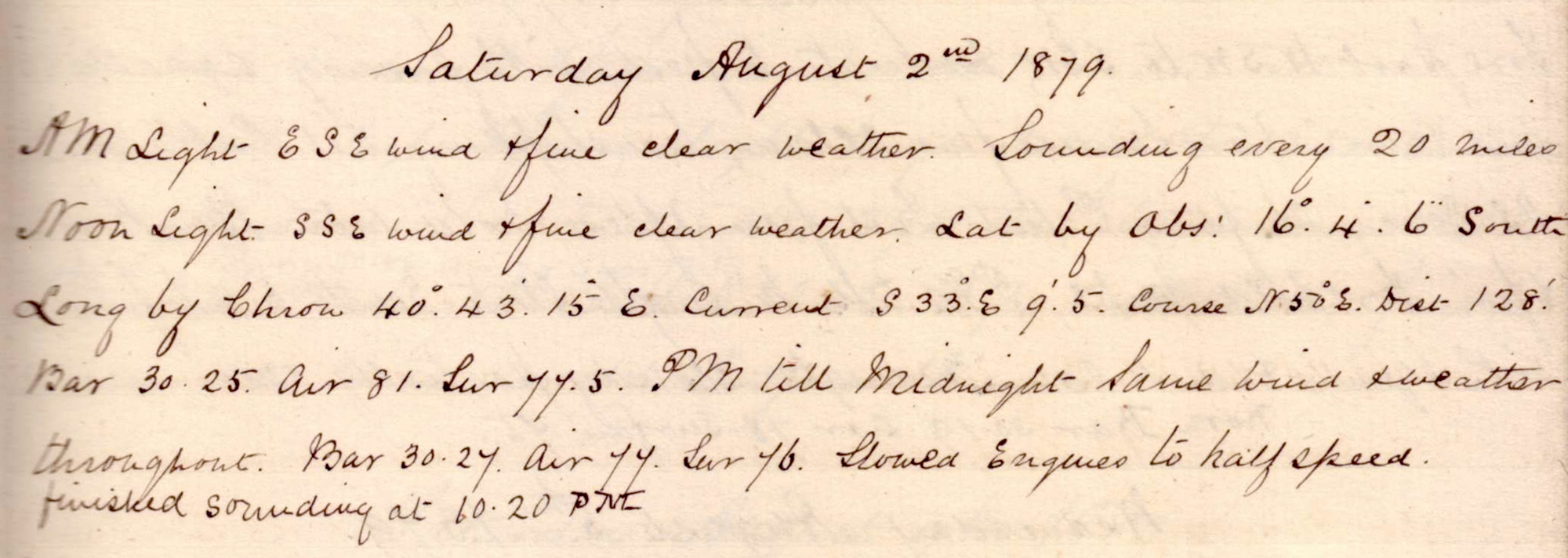 |
click on image to view high resolution version (5x) |
Remark book entry yet to be transcribed.
Sunday, 03 August 1879
 |
click on image to view high resolution version (5x) |
Remark book entry yet to be transcribed.
Monday, 04 August 1879
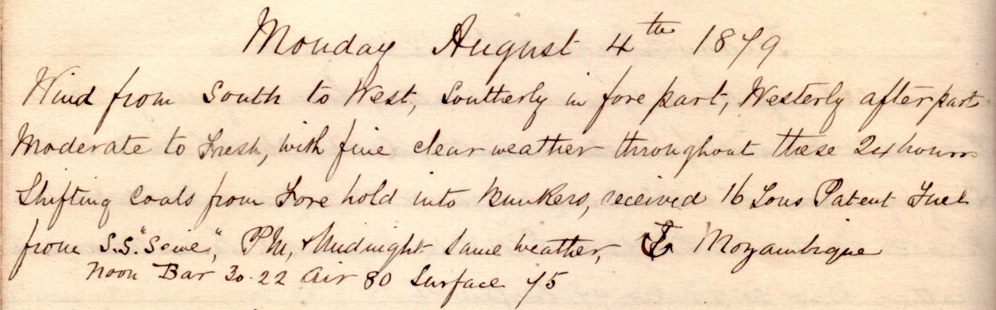 |
click on image to view high resolution version (5x) |
Remark book entry yet to be transcribed.
Tuesday, 05 August 1879
 |
click on image to view high resolution version (5x) |
Remark book entry yet to be transcribed.
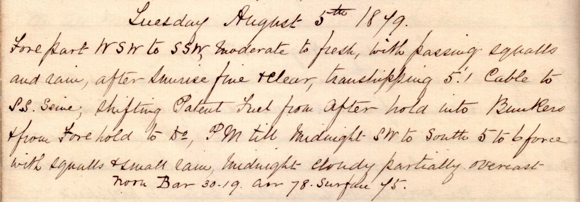
Wednesday, 06 August 1879
 |
click on image to view high resolution version (5x) |
| Note the date of the entry actually reads "August 5th". This is a "typo" as this entry is for Wednesday and lays, in the remark book, between Tuesday 05 August 1879 and Thursday 07 August 1879. |
Remark book entry yet to be transcribed.
Thursday, 07 August 1879
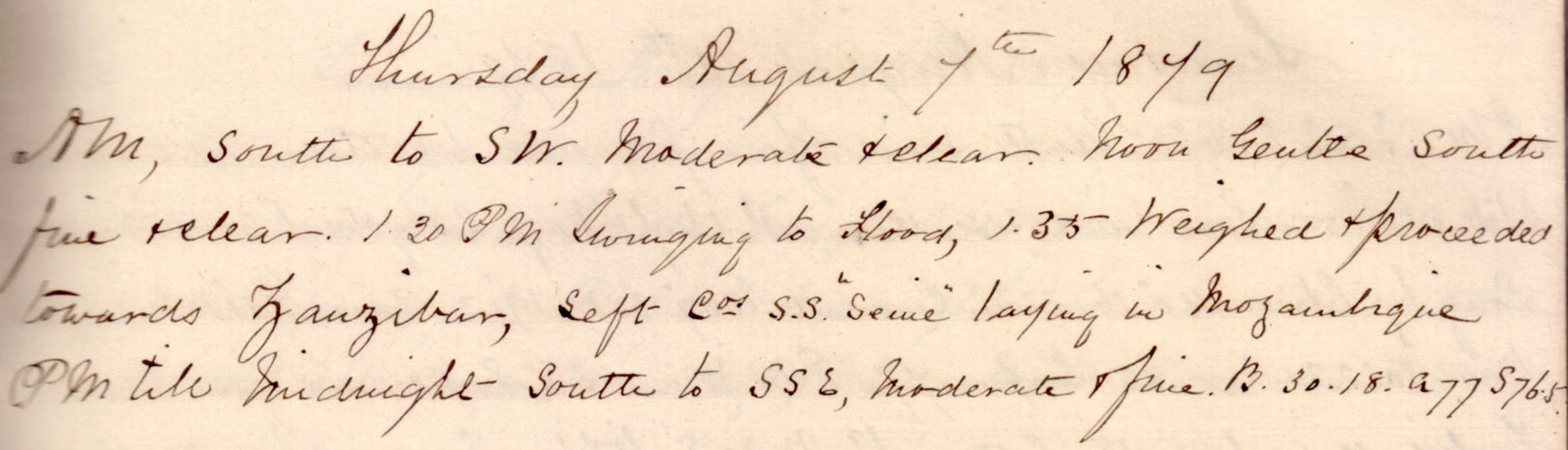 |
click on image to view high resolution version (5x) |
Remark book entry yet to be transcribed.
Friday, 08 August 1879
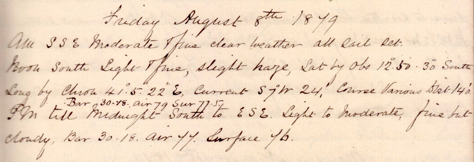 |
click on image to view high resolution version (5x) |
Remark book entry yet to be transcribed.
Saturday, 09 August 1879
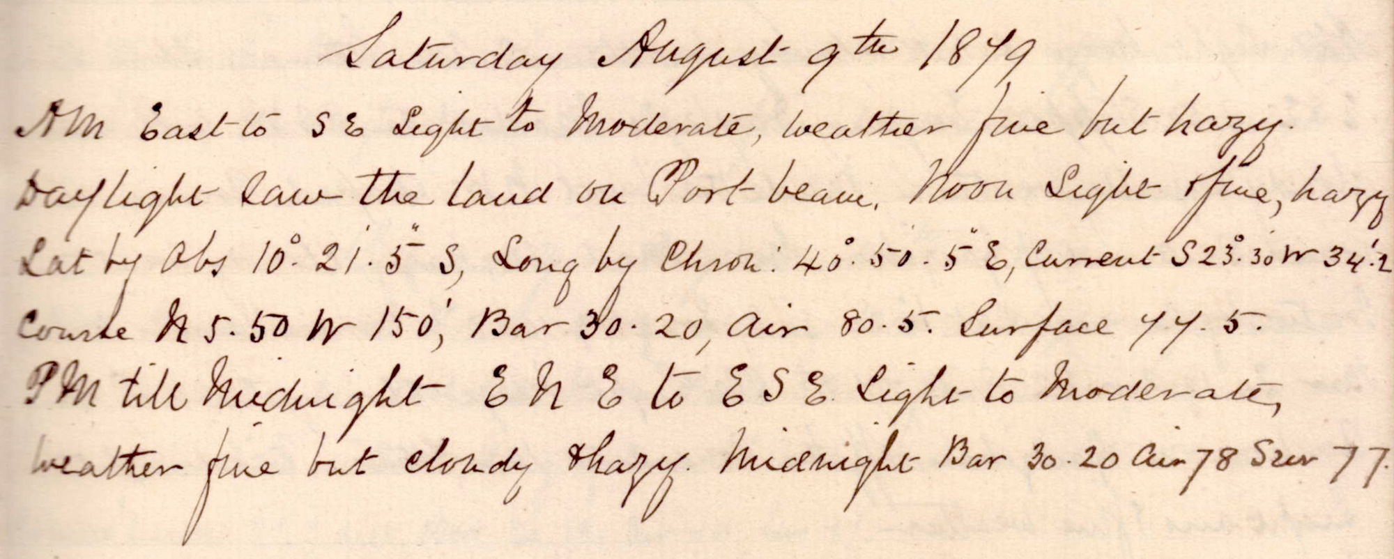 |
click on image to view high resolution version (5x) |
Remark book entry yet to be transcribed.
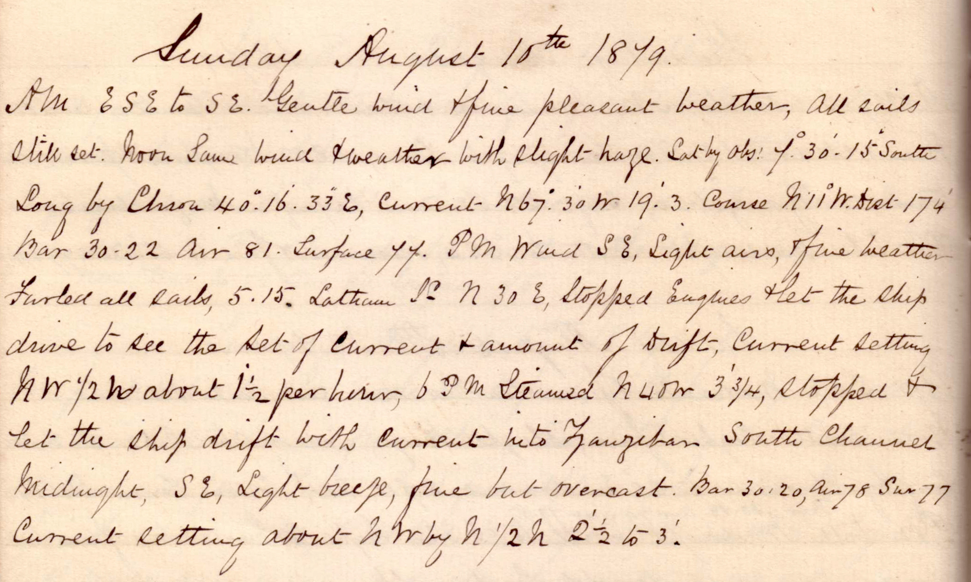
Sunday, 10 August 1879
 |
click on image to view high resolution version (5x) |
Arriving Zanzibar.
"All sails still set."
Noon position: S 7° 30' 15" E 40° 16' 33".
"Furled all sails, 5.15pm Latham [?] N30E, Stopped engines & let the ship drive to see the set of current & amount of drift, Current setting NW 1/2 [?] abbout 1 1/2 per hour." "6pm Steamed N40W 3 3/4, topped & let ship drift with current into Zanzibar South Channel."
Monday, 11 August 1879
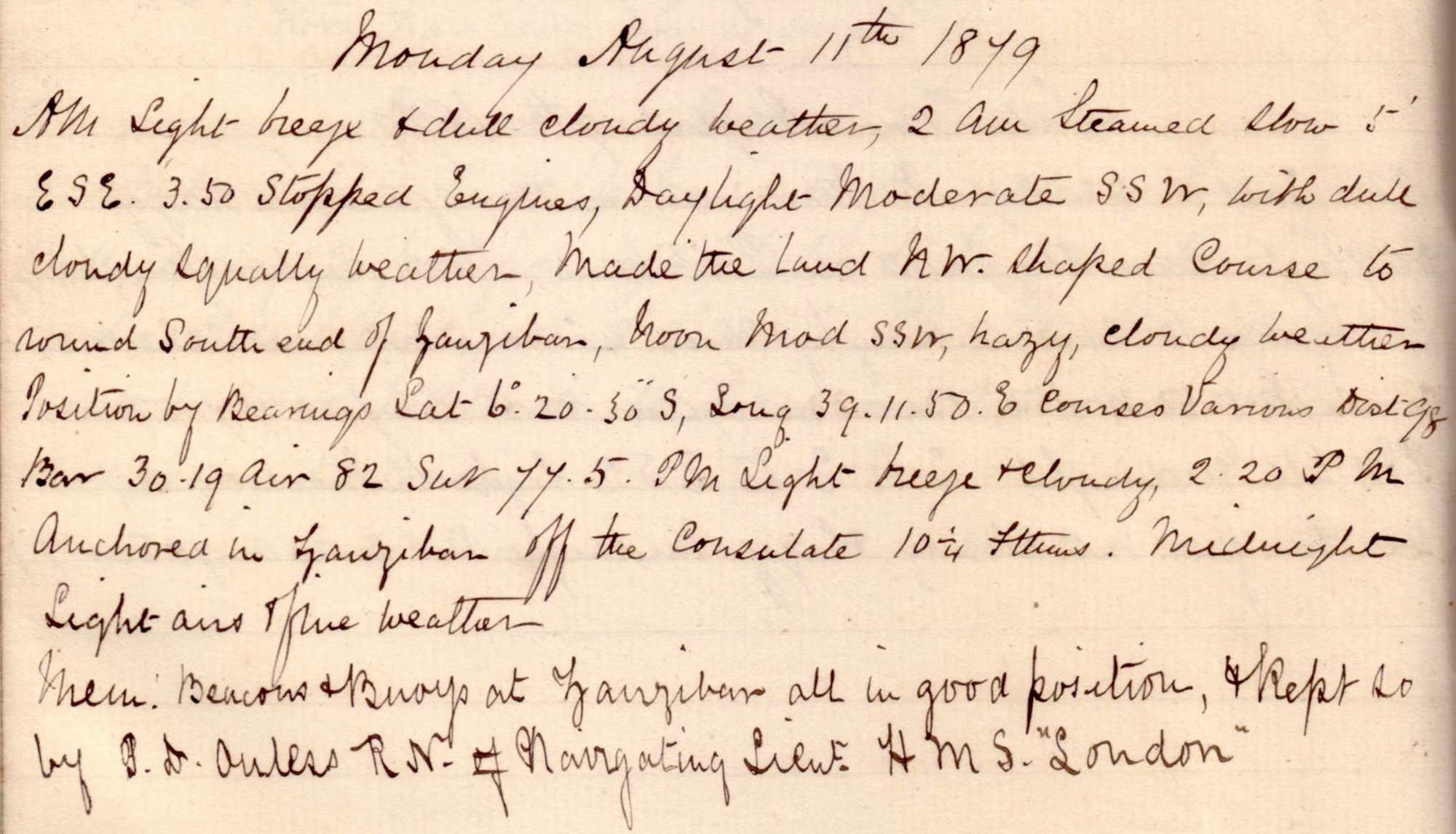 |
click on image to view high resolution version (5x) |
"2am Steamed slow 5' ESE. 3.50 Stopped Engines, Daylight moderate SSW, with dull cloudy squally weather, Made the land NW. Shaped course to round South end of Zanzibar."
Noon position: S 6° 20' 30" E 39° 11' 50".
"2.20pm Anchored in Zanzibar off the Consulate 10 1/4 fathoms.
"Mem[?]: Beacons & buoys at Zanzibar all in good position, & kept so by [??] P D Auless RN Navigating Lieut. HMS 'London'."
Tuesday, 12 August 1879
 |
click on image to view high resolution version (5x) |
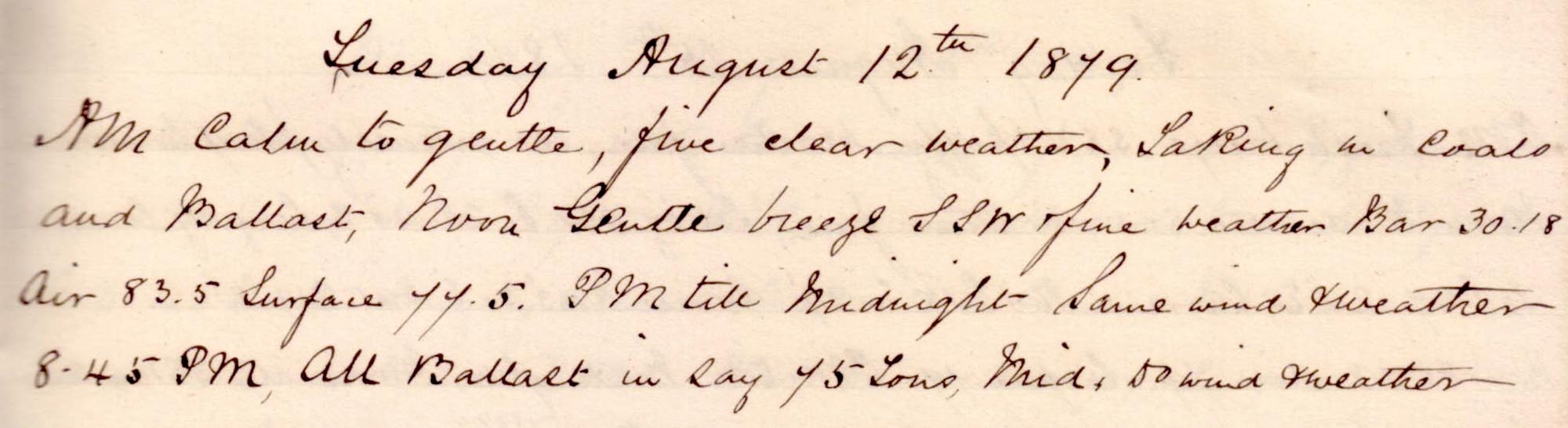
"Taking in coals and Ballast."
"8.45pm All ballast in [??] 75 tons."
Wednesday, 13 August 1879
 |
click on image to view high resolution version (5x) |
"Took in one lighter coals, 10.40am weighed and proceeded towards Aden, Noon, through English Pass."
"PM Steering along the land inside all reefs. 2.20pm North end Zanzibar abeam, [?] opening the passage between Zanzibar & Pemba, had a very strong set to the WNW. In the Pemba Channel, 8.45pm North end of Pemba island abeam, hauled ship out to clear offlying reefs of main land."
Thursday, 14 August 1879
 |
click on image to view high resolution version (5x) |
"AM, All possible sail set."
Noon position: S 3° 0' 4" E 41° 16' 10".
Friday, 15 August 1879
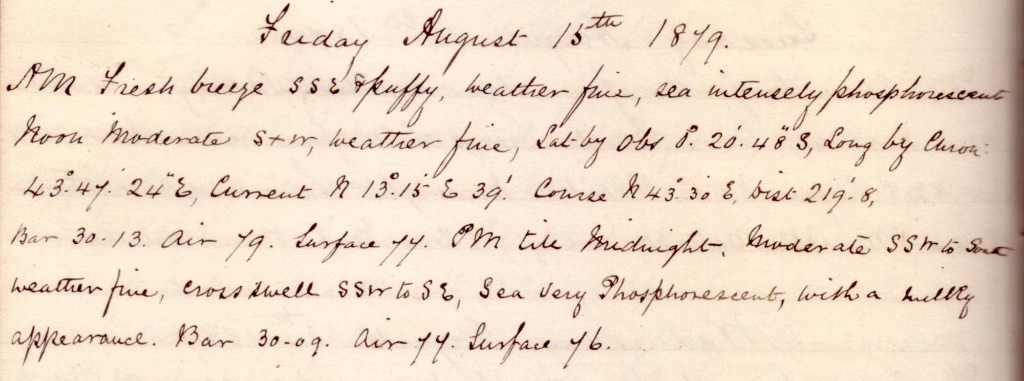 |
click on image to view high resolution version (5x) |
"sea intensely phosphorescent." "Sea very phosphorescent, with a milky appearance."
Noon position: S 0° 20' 48" E 43° 47' 24".
Saturday, 16 August 1879
 |
click on image to view high resolution version (5x) |
Remark book entry yet to be transcribed.
Sunday, 17 August 1879
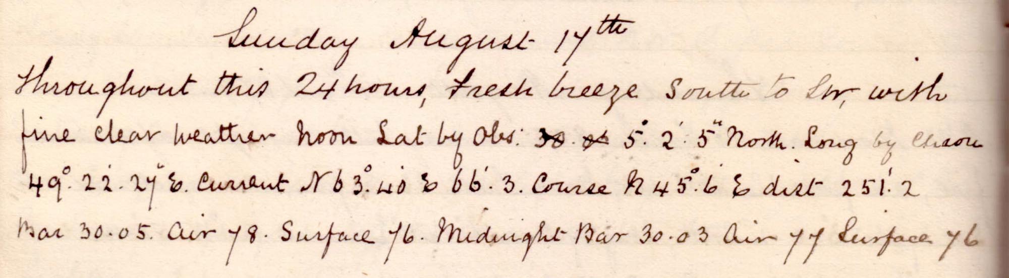 |
click on image to view high resolution version (5x) |
Remark book entry yet to be transcribed.
Monday, 18 August 1879
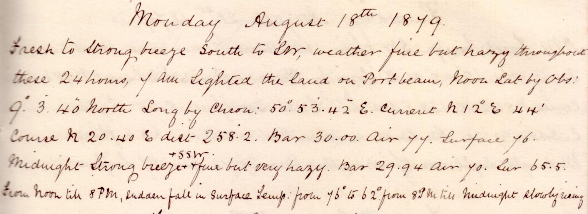 |
click on image to view high resolution version (5x) |
Remark book entry yet to be transcribed.
Tuesday, 19 August 1879
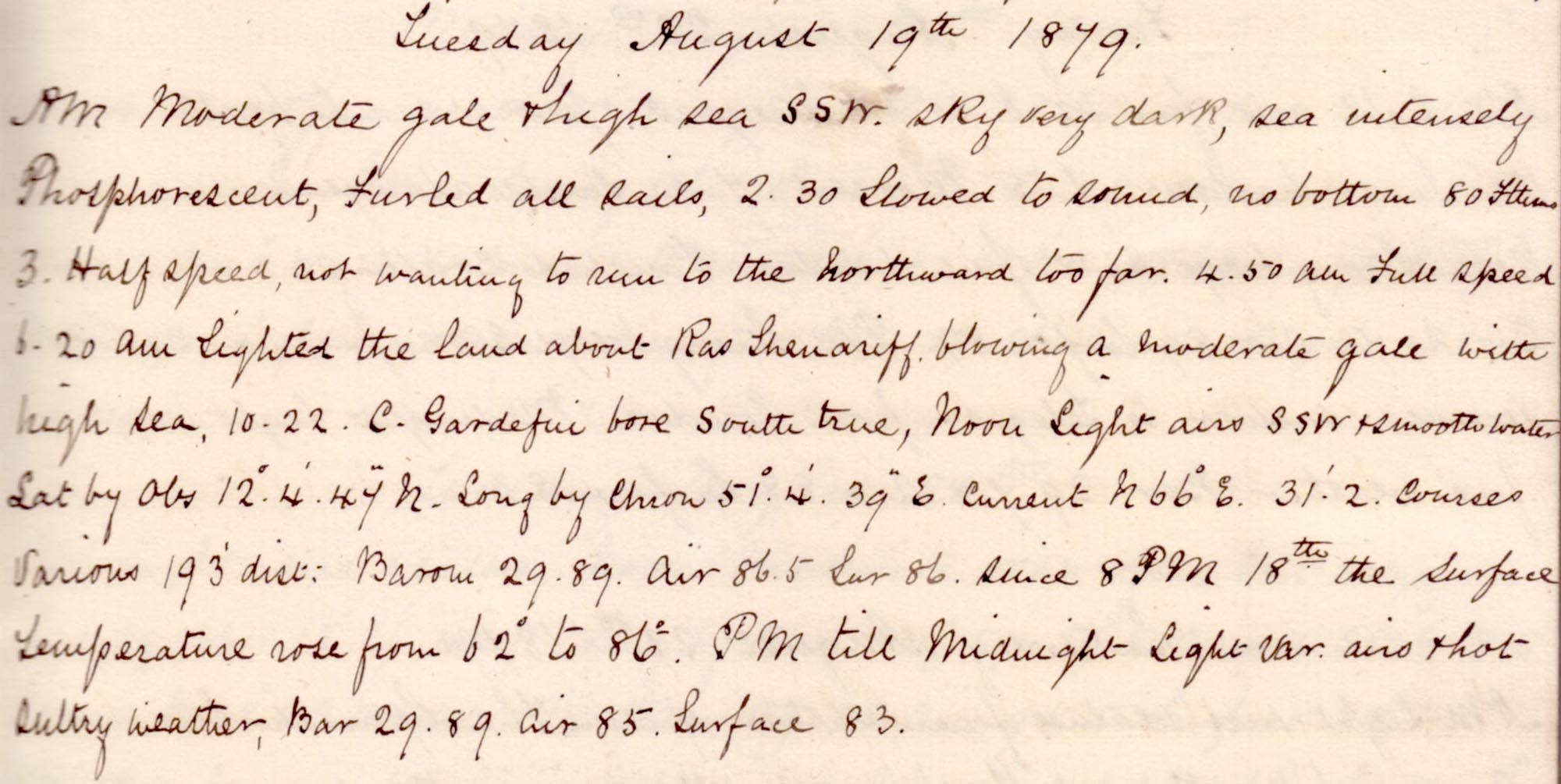 |
click on image to view high resolution version (5x) |
Remark book entry yet to be transcribed.
Wednesday, 20 August 1879
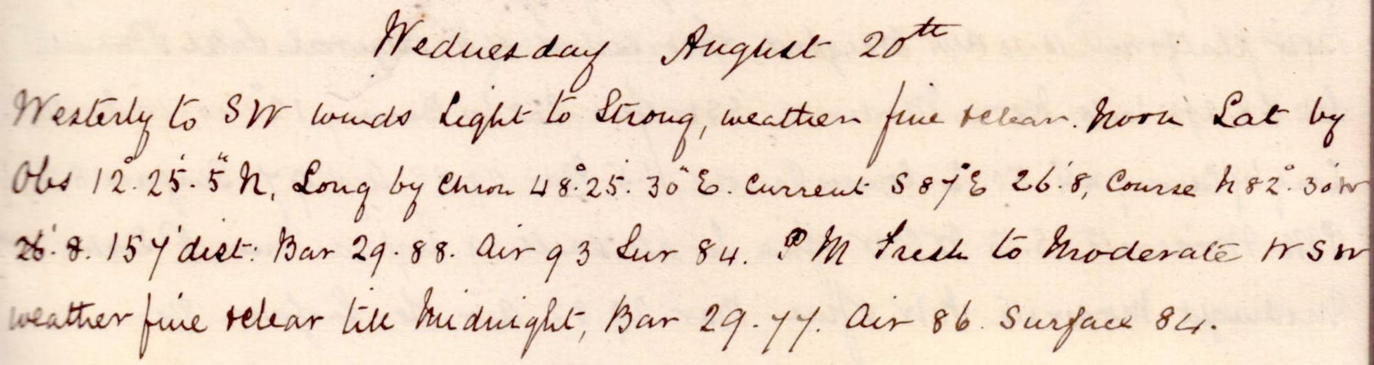 |
click on image to view high resolution version (5x) |
Remark book entry yet to be transcribed.
Thursday, 21 August 1879
 |
click on image to view high resolution version (5x) |
Noon position: N 12° 42' 31" E 46° 4' 34".
"5.45pm. Sighted C Aden. 9.20 Anchored in Aden outer roads in 5 1/2 fathoms."
Friday, 22 August 1879
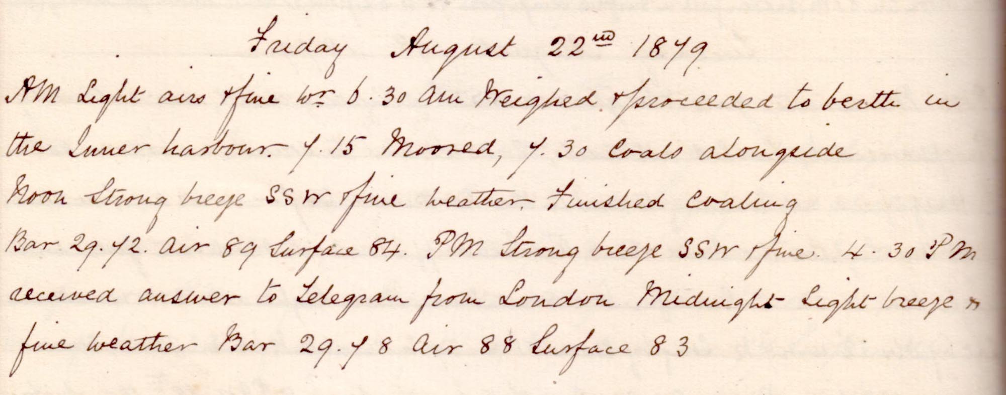 |
click on image to view high resolution version (5x) |
"6.30am Weighed & proceeded to berth in the Inner Harbour. 7.15 moored, 7.30 Coals alongside"
"Noon ... finished coaling." "4.30pm received answer to telegram from London."
Saturday, 23 August 1879
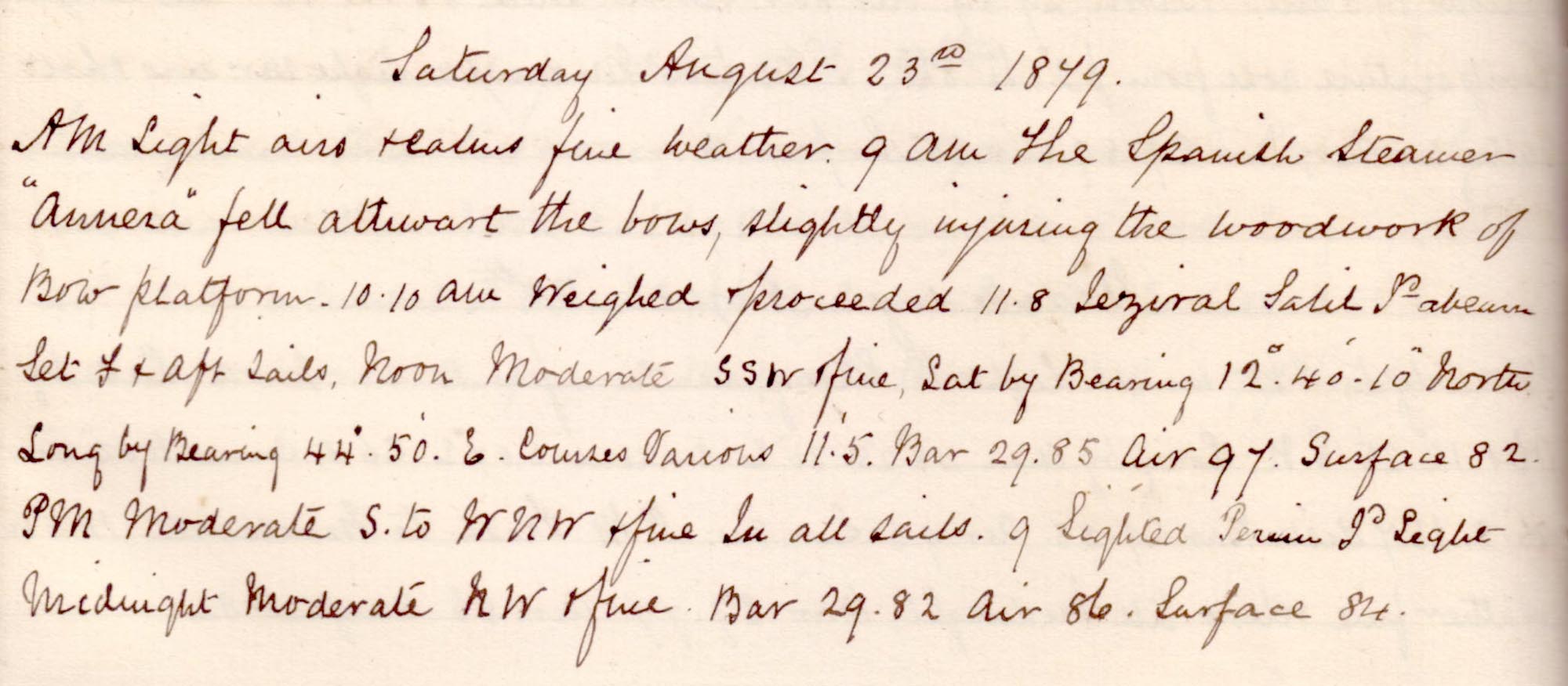 |
click on image to view high resolution version (5x) |
Remark book entry yet to be transcribed.
Sunday, 24 August 1879
 |
click on image to view high resolution version (5x) |
Remark book entry yet to be transcribed.
Monday, 25 August 1879
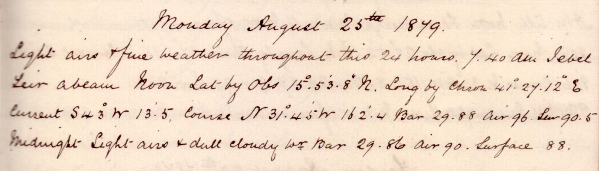 |
click on image to view high resolution version (5x) |
Remark book entry yet to be transcribed.
Tuesday, 26 August 1879
 |
click on image to view high resolution version (5x) |
Remark book entry yet to be transcribed.
Wednesday, 27 August 1879
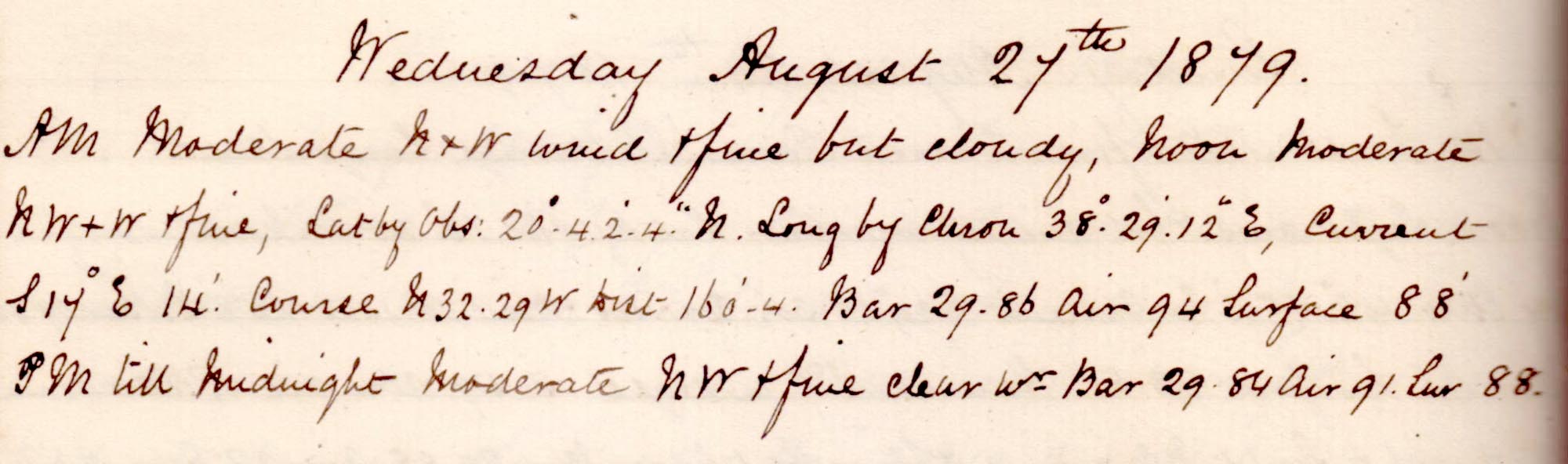 |
click on image to view high resolution version (5x) |
Remark book entry yet to be transcribed.
Thursday, 28 August 1879
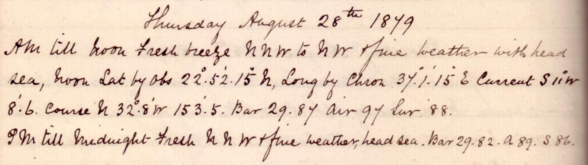 |
click on image to view high resolution version (5x) |
Remark book entry yet to be transcribed.
Friday, 29 August 1879
 |
click on image to view high resolution version (5x) |
Remark book entry yet to be transcribed.
Saturday, 30 August 1879
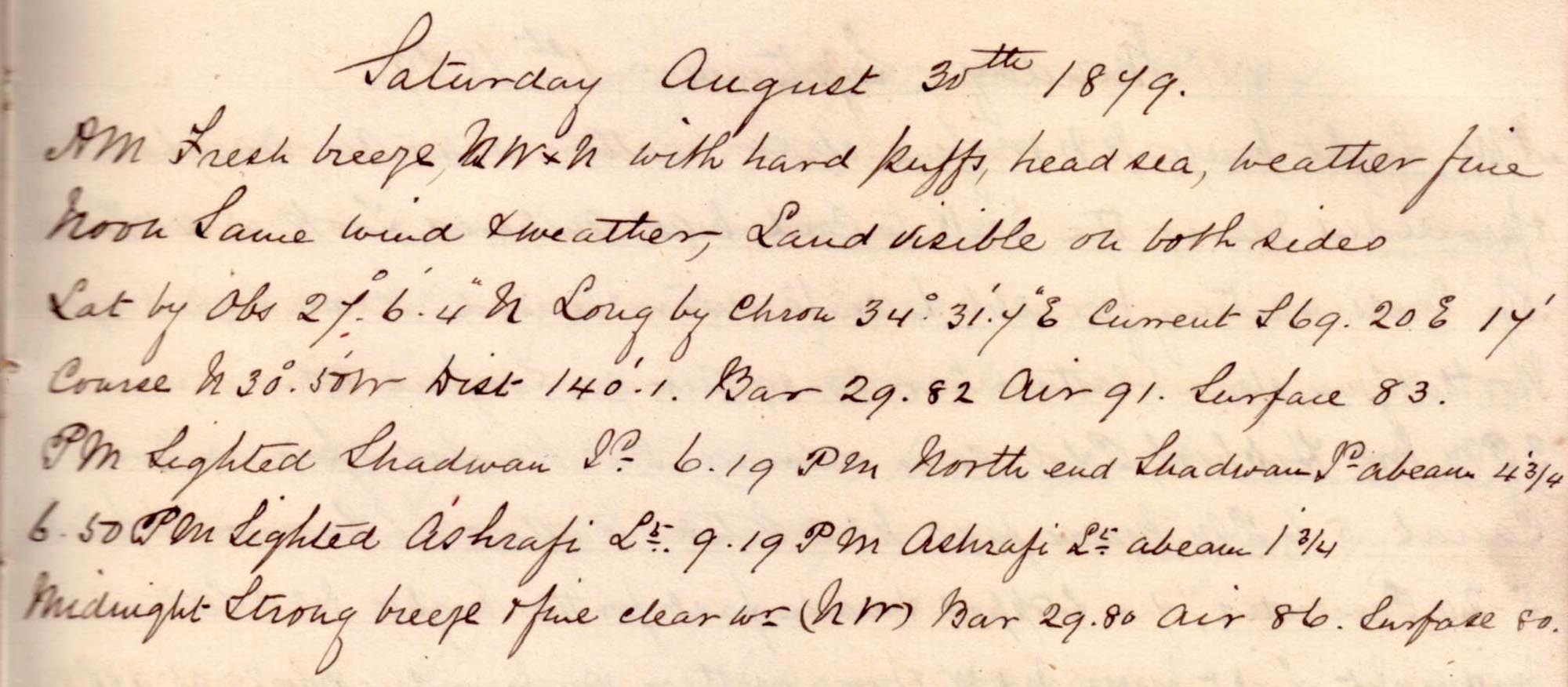 |
click on image to view high resolution version (5x) |
Remark book entry yet to be transcribed.
Sunday, 31 August 1879
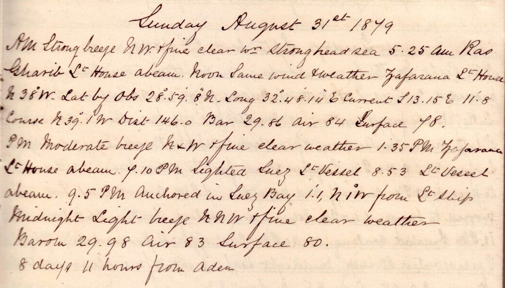 |
click on image to view high resolution version (5x) |
noon position: N 28° 59' 8" E 32° 48' 14".
"7.10p, sighted Suez Light Vessel. 8.53 Light Vessel abeam. 9.5pm Anchored in Suez Bay."
"8 days 11 hours from Aden"
Monday, 01 September 1879
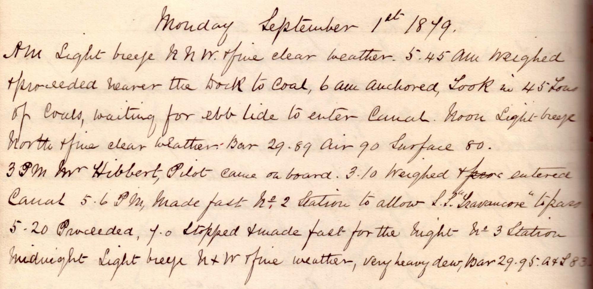 |
click on image to view high resolution version (5x) |
Remark book entry yet to be transcribed.
Tuesday, 02 September 1879
 |
click on image to view high resolution version (5x) |
Remark book entry yet to be transcribed.
Wednesday, 03 September 1879
 |
click on image to view high resolution version (5x) |
Remark book entry yet to be transcribed.
Thursday, 04 September 1879
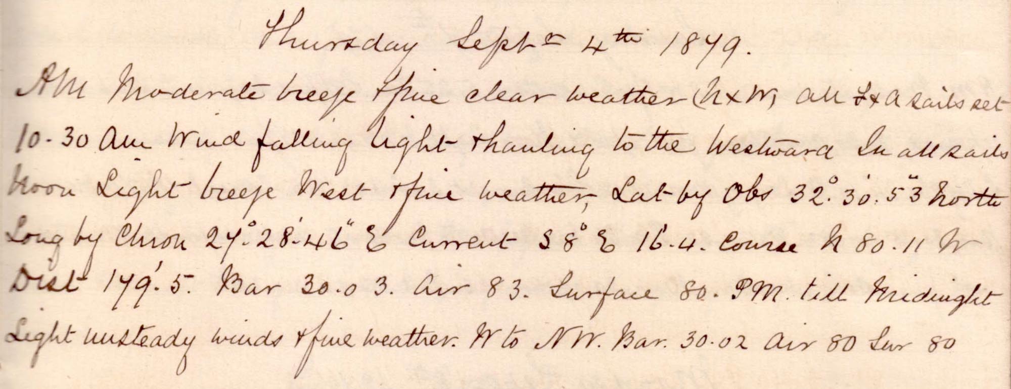 |
click on image to view high resolution version (5x) |
Remark book entry yet to be transcribed
Friday, 05 September 1879
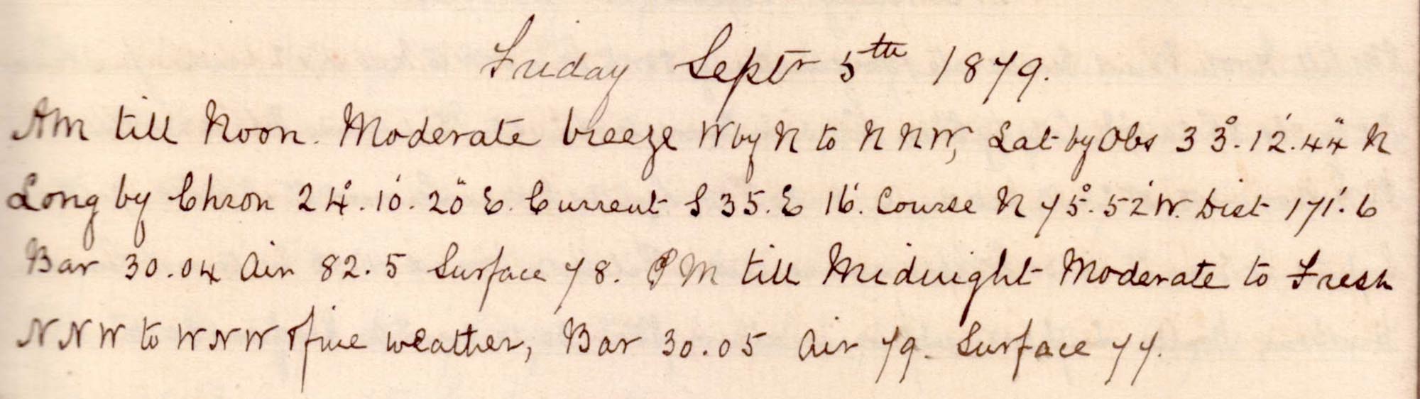 |
click on image to view high resolution version (5x) |
Remark book entry yet to be transcribed
Saturday, 06 September 1879
 |
click on image to view high resolution version (5x) |
Remark book entry yet to be transcribed
Sunday, 07 September 1879
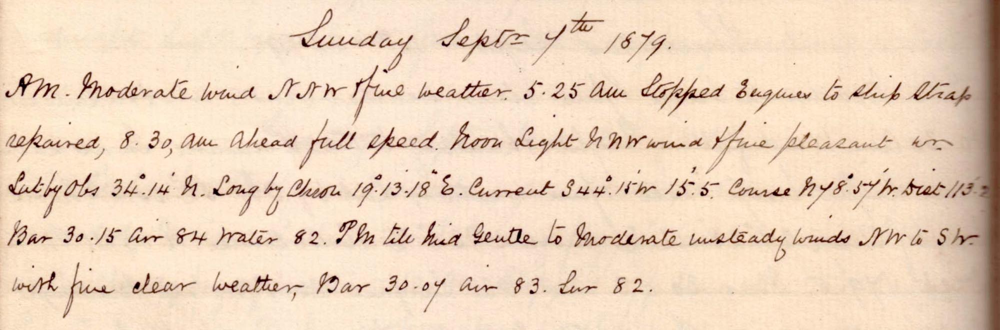 |
click on image to view high resolution version (5x) |
Remark book entry yet to be transcribed
Monday, 08 September 1879
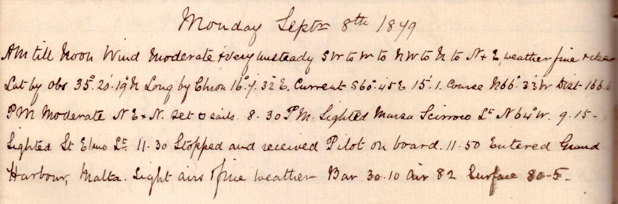 |
click on image to view high resolution version (5x) |
Remark book entry yet to be transcribed
Tuesday, 09 September 1879
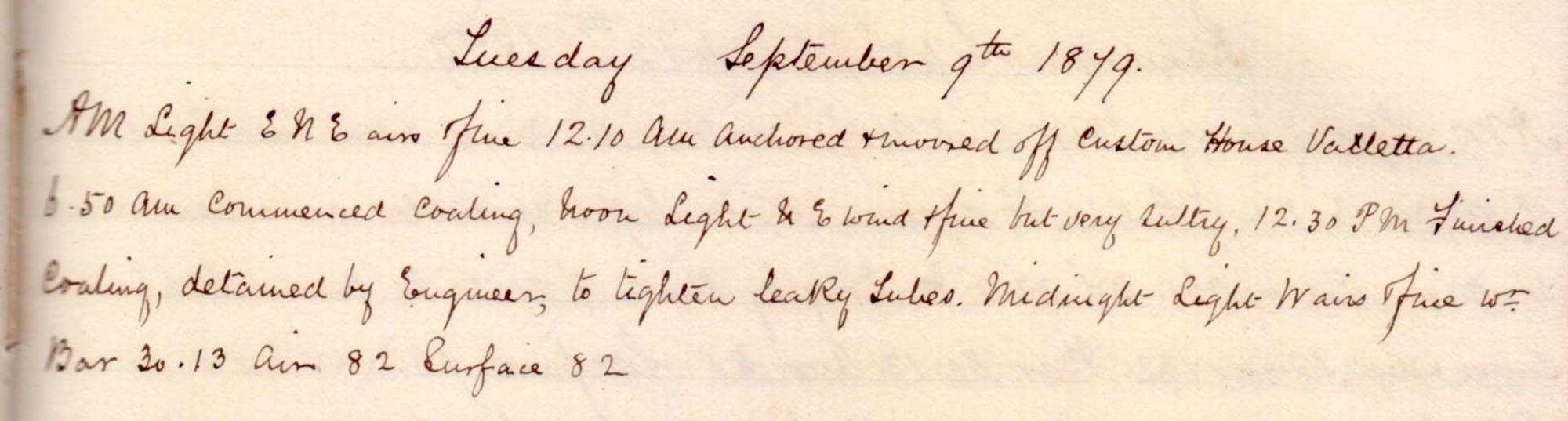 |
click on image to view high resolution version (5x) |
Remark book entry yet to be transcribed
Wednesday, 10 September 1879
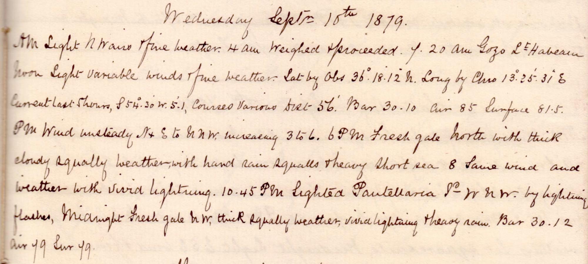 |
click on image to view high resolution version (5x) |
Remark book entry yet to be transcribed
Thursday, 11 September 1879
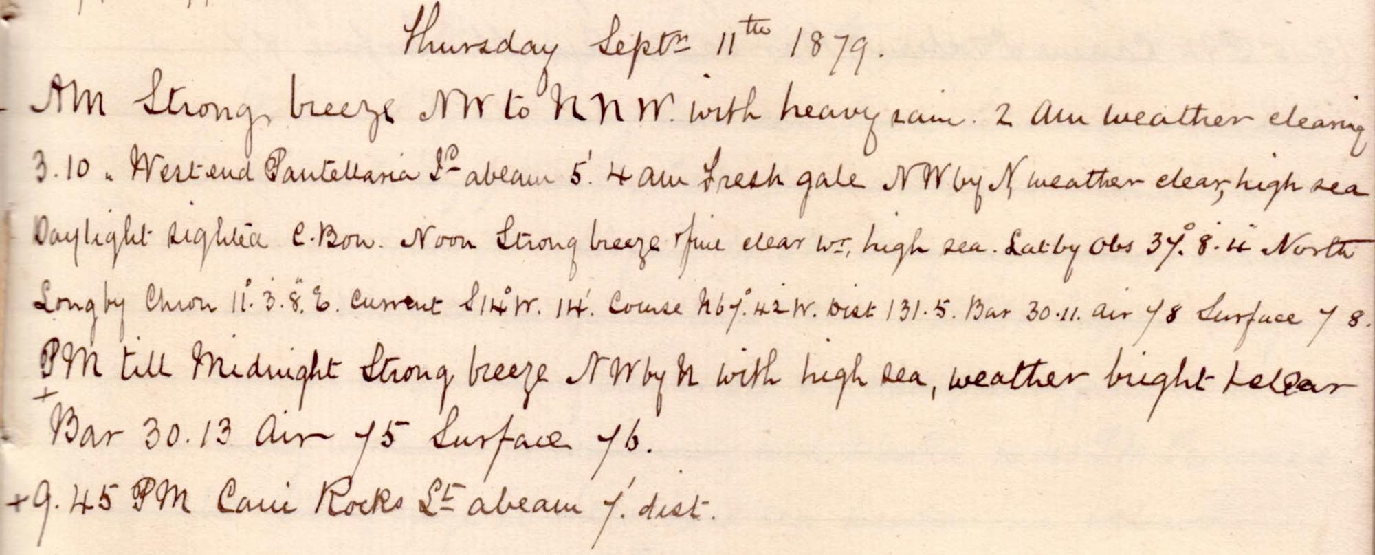 |
click on image to view high resolution version (5x) |
Remark book entry yet to be transcribed
Friday, 12 September 1879
 |
click on image to view high resolution version (5x) |
Remark book entry yet to be transcribed
Saturday, 13 September 1879
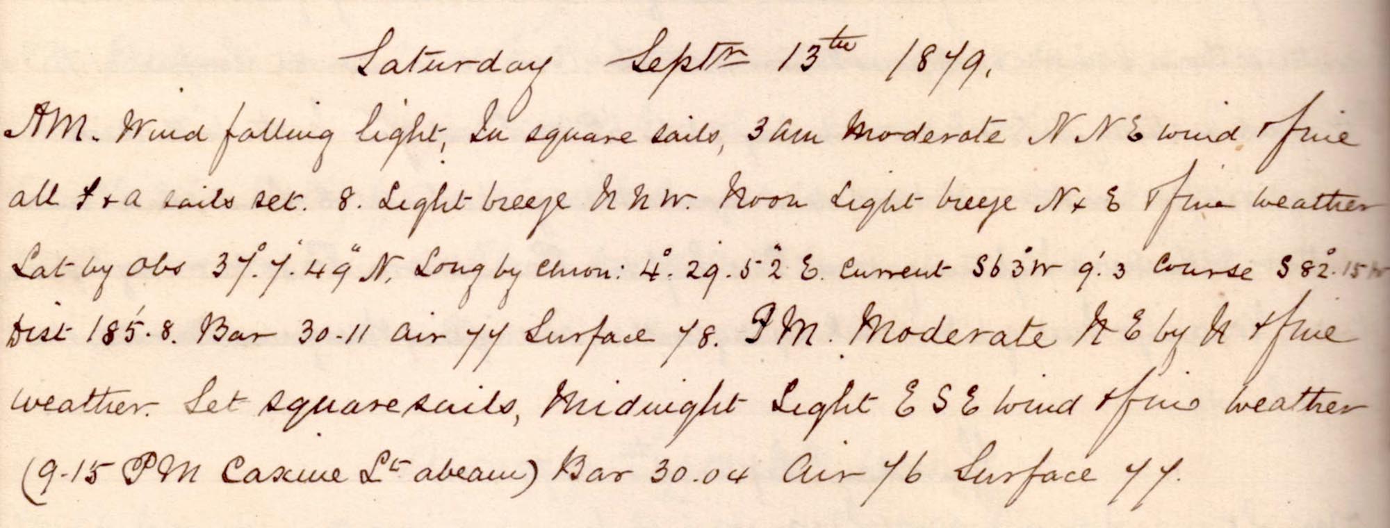 |
click on image to view high resolution version (5x) |
Remark book entry yet to be transcribed.
Sunday, 14 September 1879
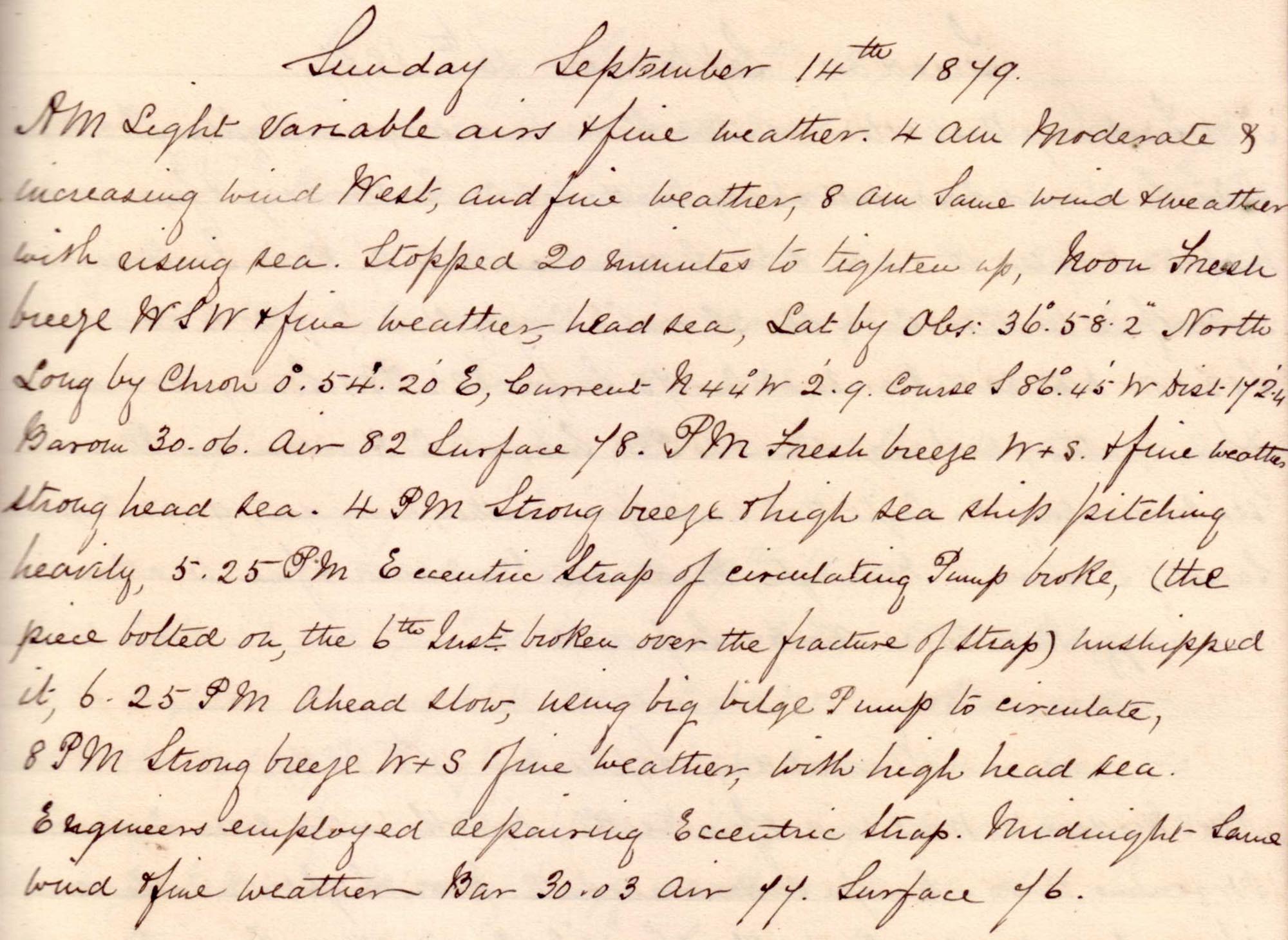 |
click on image to view high resolution version (5x) |
Remark book entry yet to be transcribed.
Monday, 15 September 1879
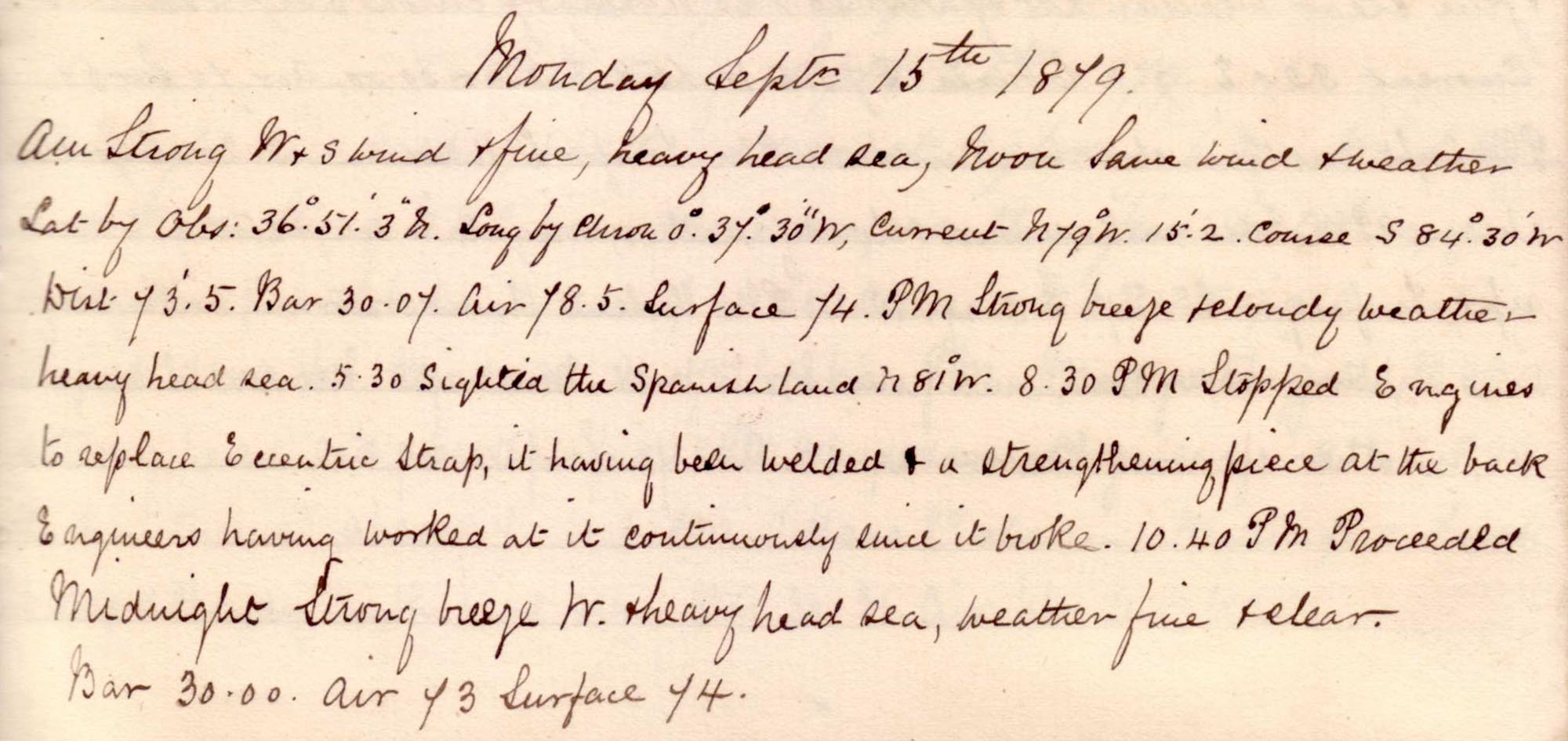 |
click on image to view high resolution version (5x) |
Remark book entry yet to be transcribed.
Tuesday, 16 September 1879
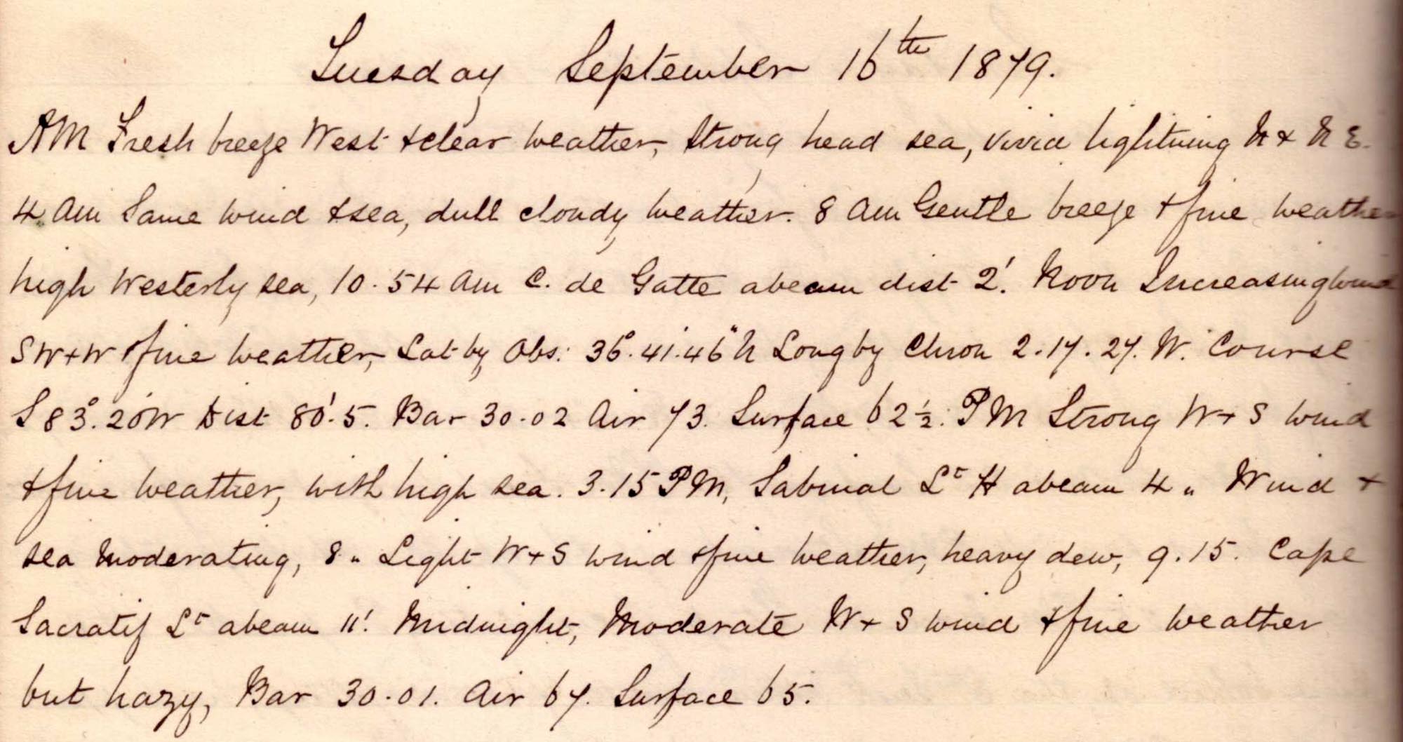 |
click on image to view high resolution version (5x) |
Remark book entry yet to be transcribed.
Wednesday, 17 September 1879
 |
click on image to view high resolution version (5x) |
Remark book entry yet to be transcribed.
Thursday, 18 September 1879
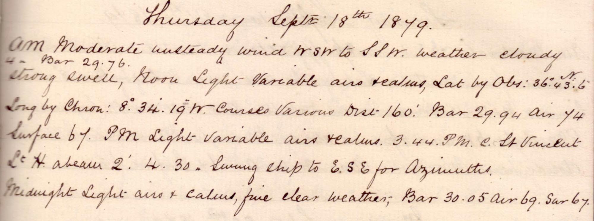 |
click on image to view high resolution version (5x) |
Remark book entry yet to be transcribed.
Friday, 19 September 1879
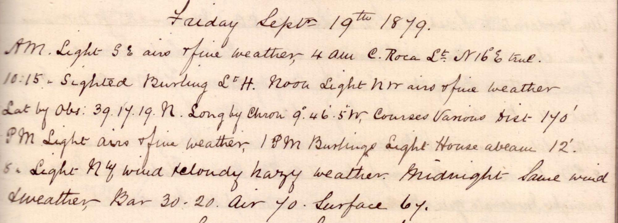 |
click on image to view high resolution version (5x) |
Remark book entry yet to be transcribed.
Saturday, 20 September 1879
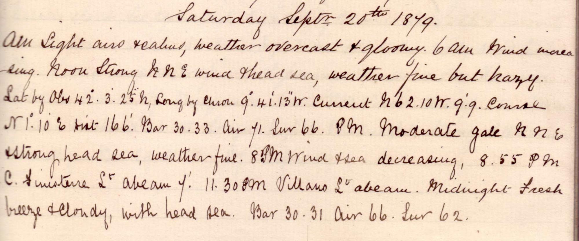 |
click on image to view high resolution version (5x) |
Remark book entry yet to be transcribed.
Sunday, 21 September 1879
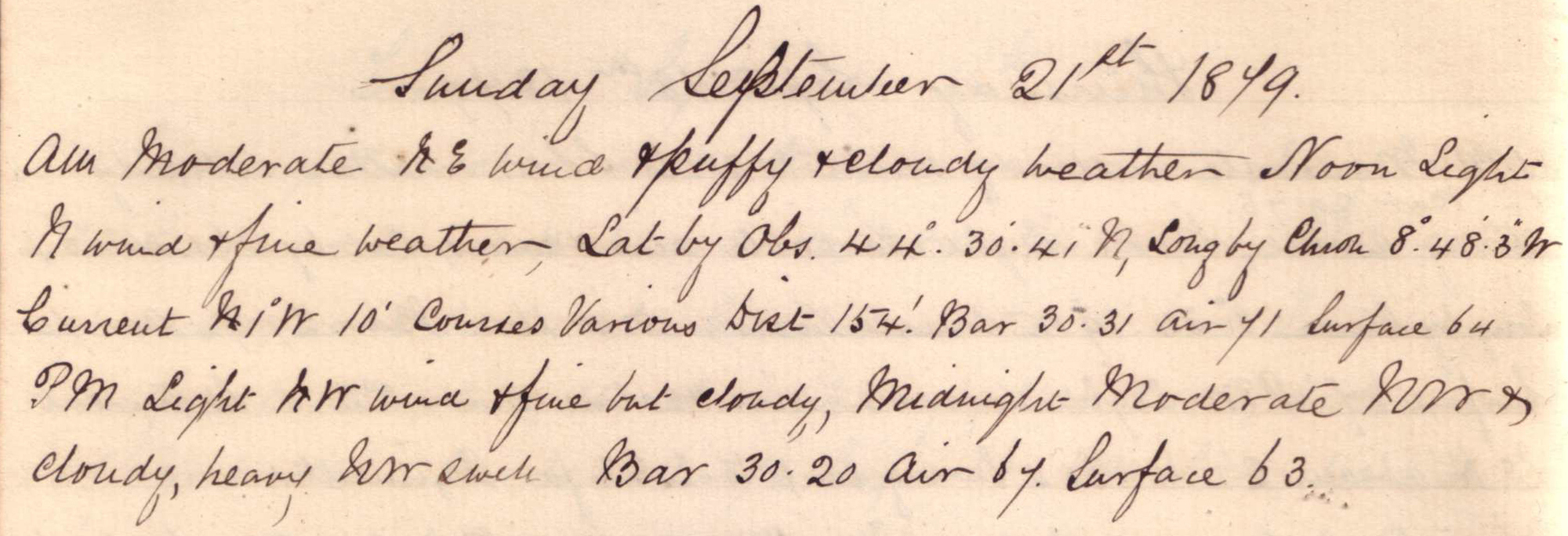 |
click on image to view high resolution version (5x) |
Sailing North, past Portugal and Spain, for the SW entrance to the English Channel.
Noon position: N 44° 30' 41" W 8° 48' 3", about 120km offshore from the NW tip of Spain.
Monday, 22 September 1879
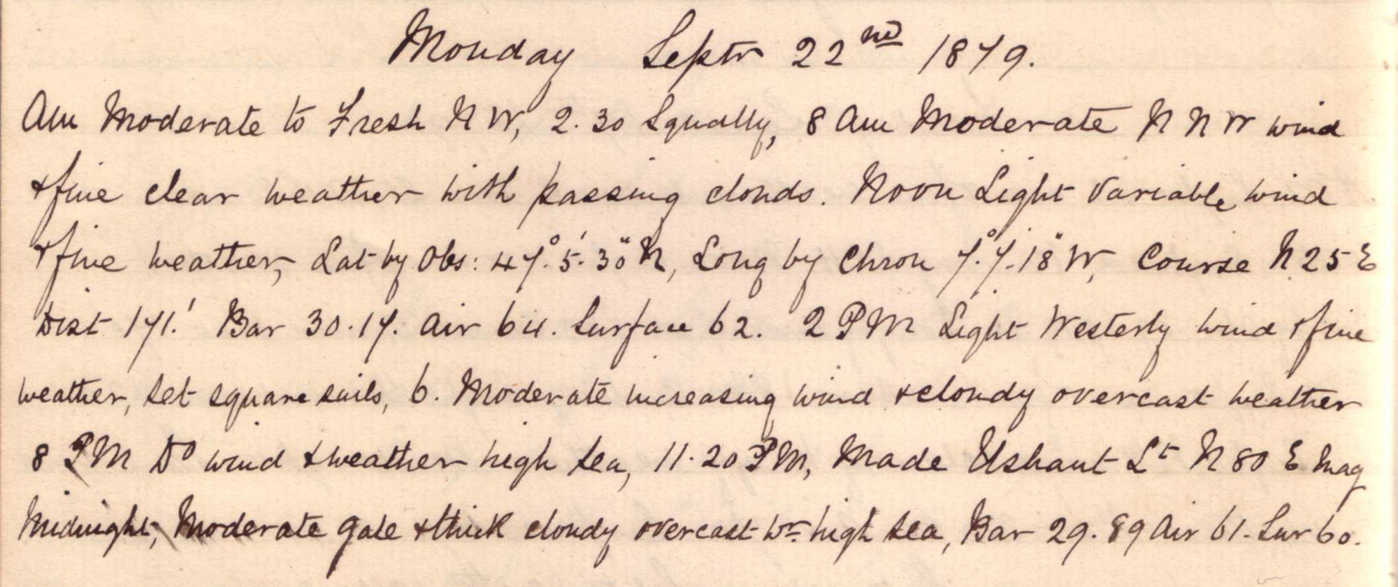 |
click on image to view high resolution version (5x) |
"Fine clear weather with passing clouds" in the morning, and "Moderate gale" that night.
Noon position: N 47° 5' 30" W 7° 7' 18°, almost half way across the mouth of the Bay of Biscay heading North. Similar position to 12 April 1879.
"11.30pm Made Ushant light."
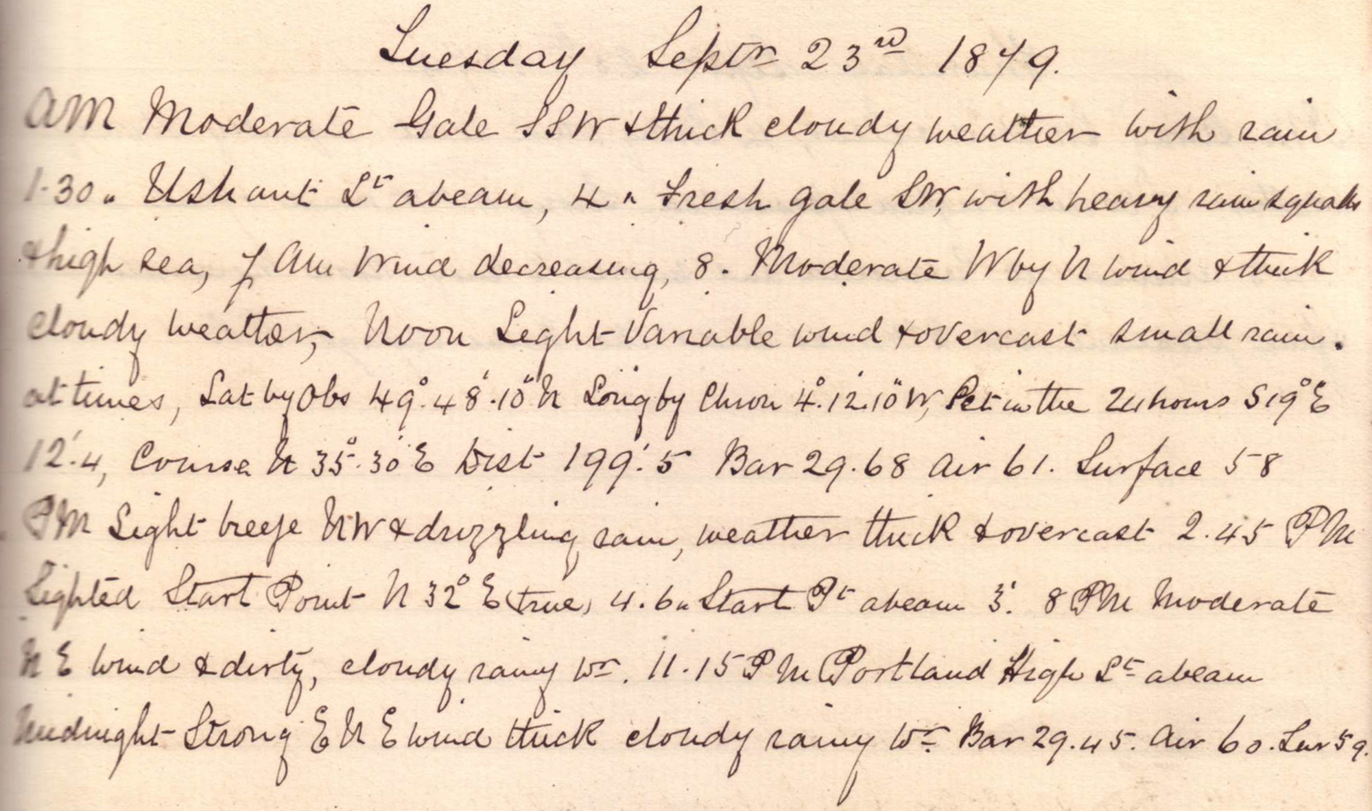
Tuesday, 23 September 1879
 |
click on image to view high resolution version (5x) |
Heading into English Channel from SW.
Noon position: N 49° 48' 10" W 4° 12' 10", at SW end of the English Channel about halfway between England & France. Similar position to 11 April 1879.
"2.45pm Sighted Start Point N32°E true." "11.15pm Portland High light abeam."
Wednesday, 24 September 1879
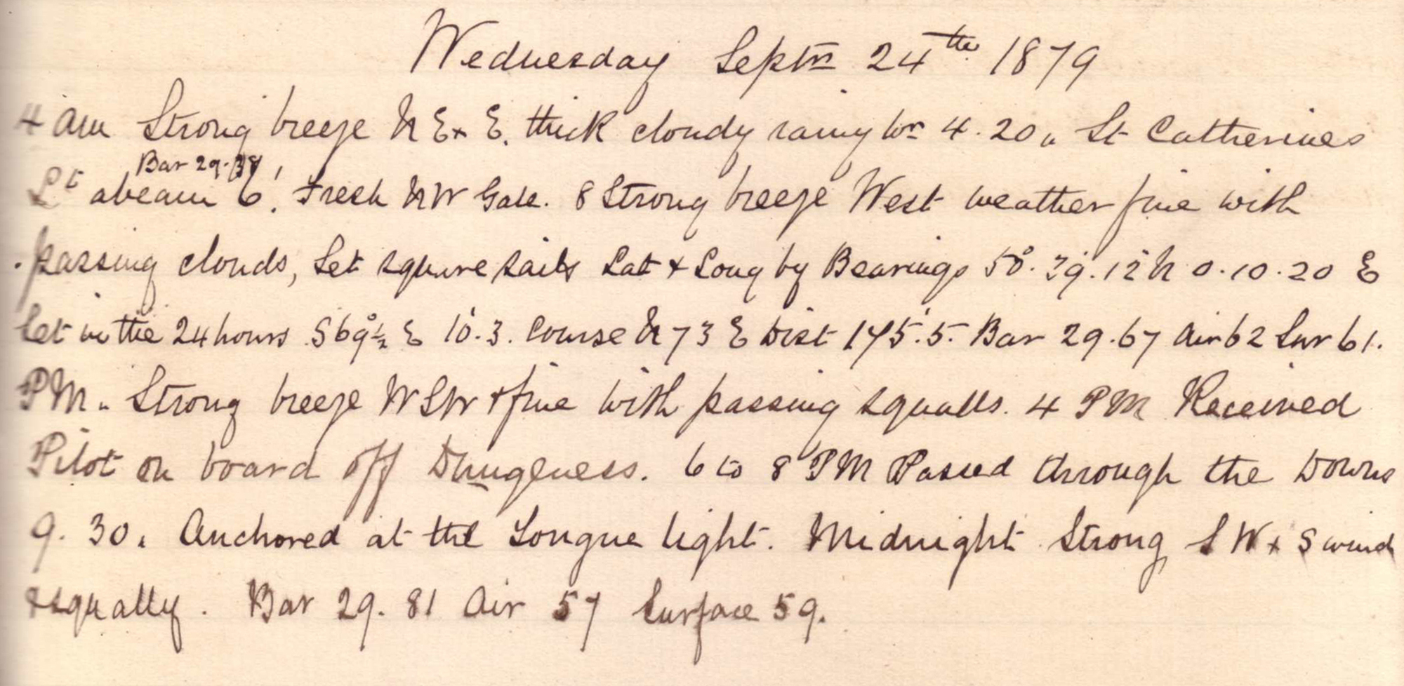 |
click on image to view high resolution version (5x) |
Navigating the English Channel.
Noon position: N 50° 39' 12" E 0° 10' 20", 10km off English S coast about 30km SE of Brighton.
"4pm received pilot on board off Dungeness. 6 to 8pm passed through the Downs. 9.30 anchored at the Tongue light."
Thursday, 25 September 1879
 |
click on image to view high resolution version (5x) |
"5:30am Weighed & proceeded." "11.45 arrived at Gravesend and moored to buoy."
"Noon. Moderate breeze & fine pleasant weather, WNW. So ends the Natal voyage. J.S."
| Return to: | Atlantic Cable main page |
| SS Kangaroo |